
Humacao, Puerto Rico facts for kids
Quick facts for kids
Humacao
Municipio Autónomo de Humacao
|
|||
|---|---|---|---|
|
City and Municipality
|
|||
|
From top, left to right: Downtown Humacao from the city hall; Palmas del Mar; Humacao Co-Cathedral; and the Humacao Monument
|
|||
|
|||
| Nicknames:
"La Perla del Oriente", "La Ciudad Gris", "Roye Huesos"
|
|||
| Anthem: "Humacao, Hijo del Taíno Bravío" | |||

Map of Puerto Rico highlighting Humacao Municipality
|
|||
| Sovereign state | United States | ||
| Commonwealth | Puerto Rico | ||
| European settlement | 16th century | ||
| Founded | April 5, 1722 | ||
| Named for | Humaka | ||
| Barrios |
13 barrios
Antón Ruíz
Buena Vista Candelero Abajo Candelero Arriba Cataño Collores Humacao barrio-pueblo junquito, humacao Pasto viejo MabúMambiche Mariana Punta Santiago Río Abajo Tejas |
||
| Area | |||
| • Total | 55.46 sq mi (143.63 km2) | ||
| • Land | 45 sq mi (117 km2) | ||
| • Water | 10.28 sq mi (26.63 km2) | ||
| Population
(2020)
|
|||
| • Total | 50,896 | ||
| • Rank | 14th in Puerto Rico | ||
| • Density | 917.78/sq mi (354.355/km2) | ||
| • Racial groups (2000 Census) |
69.7% White 12.9% Black 0.4% American Indian/An 0.3% Asian 0.0% Native Hawaiian/Pi 9.7% Some other race 6.9% Two or more races |
||
| Demonym(s) | Humacaeños | ||
| Time zone | UTC-4 (AST) | ||
| ZIP Codes |
00791, 00792, 00741
|
||
| Area code(s) | 787/939 | ||
| Major routes | |||


Humacao is a city and municipality located on the eastern coast of Puerto Rico. It is north of Yabucoa, south of Naguabo, east of Las Piedras, and west of Vieques Passage. Humacao is made up of 12 main areas called barrios, plus the downtown area known as Humacao Pueblo. It is part of the larger San Juan-Caguas-Guaynabo Metropolitan Statistical Area.
Contents
History of Humacao
.jpg)
The area where Humacao is now was once part of the Taíno region called Humaka. This region covered a part of Puerto Rico's southeast coast. It was led by a chief named Jumacao, also known as "Macao." The Taíno village was located by what is now the Humacao River.
Early Settlements and Growth
Chief Jumacao is believed to be the first Taíno chief to learn to read and write Spanish. He wrote a letter to the King of Spain Charles I. In his letter, he complained that the island's Governor was not following their peace agreement. Jumacao explained that his people were almost like prisoners of Spain. It is said that King Charles was so touched by the letter that he ordered the Governor to respect the treaty.
In the early 1500s, the region was mostly home to cattle ranchers. However, many of them lived officially in San Juan, so a proper town was not formed. Around 1721–1722, the first official settlement was created. Most of the people who lived there were immigrants from the Canary Islands.
Some settlers moved further inland to what is now Las Piedras because of attacks from Caribs, pirates, and other groups. Still, some stayed in Humacao. By 1776, a historian named Fray Íñigo Abbad y Lasierra visited the area and wrote about the people living there. By 1793, the local church was recognized, and the settlement officially became a town.
Humacao Becomes a City
By 1894, Humacao was recognized as a city. Because its population was growing, important buildings like a hospital, a theater, and a prison were built. In 1899, after the United States took over the island during the Spanish–American War, the nearby municipality of Las Piedras became part of Humacao. This lasted until 1914, when the Legislative Assembly of Puerto Rico decided to separate the two towns again.
After the Spanish-American War, Spain gave Puerto Rico to the United States under the Treaty of Paris of 1898. In 1899, the U.S. government counted the population of Puerto Rico. They found that Humacao had 14,313 people.
Recent History and Leadership
For more than ten years, Humacao was led by mayor Marcelo Trujillo Panisse. He was a basketball star when he was younger. Trujillo worked to build sports facilities and places for fine arts in the city. In March 2008, a new Roman Catholic area called the Fajardo-Humacao diocese was created.
In 2019, Luis Raul Sanchez became the temporary mayor of Humacao after Marcelo Trujillo Panisse passed away. On September 20, 2017, Hurricane Maria hit Puerto Rico. Punta Santiago in Humacao experienced a six-foot storm surge. The hurricane caused a lot of damage to homes and buildings.
Geography of Humacao
Humacao is located on the southeast coast of Puerto Rico. It shares borders with Naguabo to the north, Yabucoa to the south, and Las Piedras to the west. The Atlantic Ocean is to the east. Most of Humacao's land is flat, as it is in the Eastern Coastal Plains region. There are some small hills to the southwest and northwest. Humacao covers about 45 square miles (117 km²). Two islands, Cayo Santiago and Cayo Batata, also belong to Humacao.
Water Features and Rivers
Humacao has many rivers and creeks. Some of its rivers include Humacao, Antón Ruíz, and Candelero. Some of its creeks are Frontera, Mariana, and Del Obispo.
In 2019, new maps showed that Humacao is very likely to flood. This is because it is located where many storms enter the island. Humacao has been working on plans to reduce flooding. Coastal areas like Antón Ruíz, Punta Santiago, Río Abajo, Buena Vista, and Candelero Abajo are especially at risk.
Barrios of Humacao

Like all municipalities in Puerto Rico, Humacao is divided into smaller areas called barrios. The main government buildings, central square, and large Catholic church are in a small barrio called "el pueblo", which means "the town."
Here are the barrios in Humacao:
- Antón Ruíz
- Buena Vista
- Candelero Abajo
- Candelero Arriba
- Cataño
- Collores
- Humacao barrio-pueblo
- Mabú
- Mambiche
- Mariana
- Punta Santiago
- Río Abajo
- Tejas
Sectors within Barrios
Barrios are further divided into even smaller areas called sectores (sectors). These sectors can have different names like urbanización (urbanization), reparto (development), barriada (neighborhood), or residencial (residential area).
Special Communities in Humacao
Some communities in Puerto Rico are called Comunidades Especiales de Puerto Rico (Special Communities). These are areas where people might face challenges like social exclusion. In 2014, some of these special communities in Humacao included Antón Ruiz, Obrera neighborhood, Cotto Mabú-Fermina, Buena Vista, Parcelas Aniseto Cruz in Candelero Abajo, Parcelas Martínez in Candelero Abajo, Cataño, Punta Santiago, Verde Mar, and Cangrejos.
Population of Humacao
| Historical population | |||
|---|---|---|---|
| Census | Pop. | %± | |
| 1900 | 14,313 | — | |
| 1910 | 26,678 | 86.4% | |
| 1920 | 20,229 | −24.2% | |
| 1930 | 25,466 | 25.9% | |
| 1940 | 29,833 | 17.1% | |
| 1950 | 34,853 | 16.8% | |
| 1960 | 33,381 | −4.2% | |
| 1970 | 36,023 | 7.9% | |
| 1980 | 46,134 | 28.1% | |
| 1990 | 55,203 | 19.7% | |
| 2000 | 59,035 | 6.9% | |
| 2010 | 58,466 | −1.0% | |
| 2020 | 50,896 | −12.9% | |
| U.S. Decennial Census 1899 (shown as 1900) 1910–1930 1930–1950 1960–2000 2010 2020 |
|||
Tourism and Fun in Humacao
To encourage people to explore Puerto Rico, the Puerto Rico Tourism Company created the Voy Turistiendo ("I'm Touring") campaign. This campaign includes a passport book and a website. The Humacao page suggests visiting the Humacao Nature Reserve, the historic buildings in Humacao Pueblo, and trying local foods like Granito.

Humacao has 8 beaches, including Punta Santiago. However, Palmas del Mar Beach is known for its strong currents, so it can be dangerous.
Because Humacao is on the coast and not far from the capital, it's a popular spot for tourists. One of the most famous places is the Palmas del Mar resort. It's the largest resort in Puerto Rico, covering over 3,000 acres (12 km²). This huge resort has tennis courts, two golf courses, beach access, many restaurants, and a riding center.
Besides the beaches at Palmas del Mar, Humacao has other popular beaches like Punta Santiago, Buena Vista, Punta Candelero, and El Morrillo. The Candelero Beach Resort, built in 1973, was later bought and improved by the Suarez family.
Other interesting places to visit include the Astronomical Observatory at the University of Puerto Rico at Humacao, Casa Roig, the Guzmán Ermit, the Humacao Wildlife Refuge, and the Church Dulce Nombre de Jesús.
In the 1980s, the Puerto Rico Department of Natural and Environmental Resources created the Humacao Nature Reserve (also called the Punta Santiago Nature Reserve). The Palmas del Mar Tropical Forest is also located in Humacao.
Economy of Humacao
Burlington in Humacao employs fewer than 100 people. The store reopened in March 2019 after Hurricane Maria damaged it on September 19, 2017.
Culture and Celebrations
Festivals and Events in Humacao
Humacao celebrates its patron saint festival in December. This festival, called Fiestas Patronales Inmaculada Concepcion de Maria, is a religious and cultural event. It usually includes parades, games, local crafts, amusement rides, traditional food, and live entertainment.
The Breadfruit Festival (Festival de la Pana) takes place during the first weekend of September. It is organized by a local group called the Mariana's Recreational and Cultural Association (ARECMA). The festival focuses on dishes made with breadfruit. Visitors can also enjoy traditional Puerto Rican music, crafts, and other cultural and sports activities. It is often held in a high spot in the Mariana barrio, offering views of Humacao, Las Piedras, Naguabo, Vieques, and Yabucoa.
Humacao Grita is an urban art festival held in November.
Other festivals and events in Humacao include:
- Three Kings’ Day – January
- Festival of the Cross – May
- Flat-bottom Boat Festival – June
- Saint Cecilia Festival (for musicians) – November
- Catholic Church Community Festival – December
Sports in Humacao
The Grises basketball team (Humacao Grays) started in 2005. They are part of Puerto Rico's National Superior Basketball league. In 2010, they changed their name to the Caciques de Humacao. They play at the new Humacao Coliseum.
The Grises is also an amateur baseball team. They won one championship in 1951 and were runners-up four times (1950, 1960, 1965, and 1967).
Healthcare in Humacao
Humacao has three hospitals that provide secondary care: HIMA-San Pablo Humacao, Menonita (Hospital Oriente), and Ryder Memorial Hospital.
Symbols of Humacao
The municipality of Humacao has an official flag and a coat of arms.
Humacao Flag
The flag has three horizontal stripes. The gold stripe represents Chief Jumacao's crown. The red stripe symbolizes the coat of arms. The green stripe stands for the arrows used by the Taínos.
Humacao Coat of Arms
The coat of arms is mainly gold and green, with some red. The gold color represents the sun, as Humacao is on the eastern side of the island where the sun rises. Green symbolizes the native Indian heritage and the natural tropical valley where the city is located. The shield itself represents Humacao's original native and Indian name. Roberto Brascochea Lota designed the coat of arms in 1975, and Humacao approved it on November 13, 1975.
Transportation in Humacao
Humacao's airport is no longer used for daily flights to Vieques and Culebra. Now, it is used for private flights.
Humacao has good road access with two freeways and one toll road. Puerto Rico Highway 30, also known as Autopista Cruz Ortiz Stella, is the main highway coming from the west (from Caguas and Las Piedras). Puerto Rico Highway 53 connects Humacao from the north (from Fajardo and Naguabo) and the south (from Yabucoa). Puerto Rico Highway 60, the Carretera Dionisio Casillas, is a short freeway entirely within Humacao. It has exits that lead to downtown Humacao and Anton Ruiz.
Puerto Rico Highway 3, a major highway along Puerto Rico's east coast from San Juan, passes through Humacao. It has a special alternate route in Humacao called the Bulevar del Rio (River Boulevard). This route provides access to the city's main court building and a future theater, the Centro de Bellas Artes de Humacao (Humacao Fine Arts Center). The alternate route helps traffic bypass the busy downtown area, as PR-3 goes directly into the town's business center.
Puerto Rico Highway 908 is another important road. It starts at PR-3 and crosses PR-30. It also provides access to the University of Puerto Rico at Humacao and some major schools in the municipality.
Humacao is one of only three municipalities in Puerto Rico (along with San Juan and Salinas) that has highways with controlled access leaving its borders in all directions. There are 68 bridges in Humacao.
Education in Humacao
Humacao has many elementary and high schools. Three of these schools are recognized by the Middle States Association of Secondary Schools and have their own National Honor Society chapters. One of these is Colegio San Antonio Abad, which was founded in 1957 and is run by Benedictine monks.
The University of Puerto Rico at Humacao, once called CUH, teaches over 4,000 students. It is well-known for its science programs, producing many skilled microbiologists, marine biologists, wildlife biologists, and chemists at the undergraduate level. The university also manages an astronomical observatory where many tourists and locals visit to look at stars and planets. It also runs the Museo Casa Roig, which hosts art shows and cultural events.
Notable People from Humacao
- Rita Moreno, Academy Award-winning actress
- Edwin Núñez, professional baseball player
- Luis Rafael Sánchez, novelist and author
- Rossana Rodriguez-Sanchez, member of the Chicago City Council
- Eddie Miró, TV personality
- Julio M. Fuentes, US Circuit Court judge
- Tito Rojas, salsa singer
- Adamari López, actress
- Papulin Moyett, periodista y locutor de radio
- Jaquira Díaz, author, journalist
- Cosculluela, rapper, songwriter
- Eladio Carrión, rapper, songwriter
- Jumacao, Taino Cacique
- Benito Pastoriza Iyodo, poet, narrator, and essayist
- Carlos Ponce, actor
- Luis Antonio "Yoyo Boing" Rivera, actor and comedian
- Diplo,comedian
- Jerry Rivera, singer and dancer
- Junior Ortiz, former Major League Baseball player
- Raul Casanova, former Major League Baseball player
- Rafael Orellano, former professional baseball player
- Jantony Ortiz, professional boxer
- José Estrada Jr., former professional wrestler
- Ana Otero, Pianist, composer, arranger, conductor, activist.
- Jon Z, rapper, songwriter
- Luis Enrique Juliá, composer
- Yomo, rapper, singer
Images for kids
-
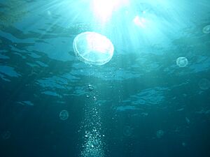
Moon jellyfish off the coast of Humacao
-
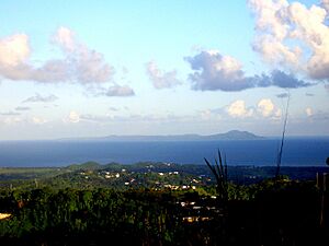
View of Vieques Island from Humacao
-
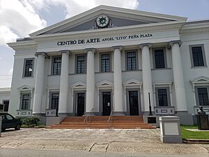
The Centro de Arte Angel "Lito" Peña Plaza in 2020, which used to be the Alcaldía or town hall of Humacao is on the US National Register of Historic Places.
-
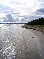
A beach in Humacao
-
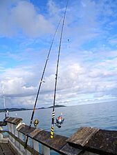
Fishing from a pier in Humacao
-
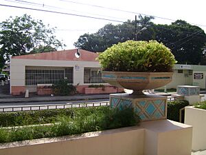
Large planter in Humacao barrio-pueblo
-
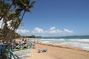
Palmas del Mar Beach
-
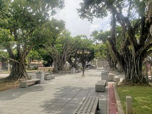
Square in the Pueblo of Humacao
-
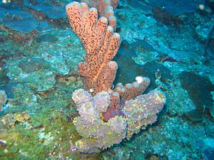
Underwater scene off the coast of Humacao


See also
 In Spanish: Humacao para niños
