
Salinas, Puerto Rico facts for kids
Quick facts for kids
Salinas
Municipio de Salinas
|
|||
|---|---|---|---|
|
Town and Municipality
|
|||
| Salinas del Abey | |||

Plaza de Salinas
|
|||
|
|||
| Nicknames:
"El Pueblo del Mojo Isleño", "Cuna del Mojito Isleño", "Los Marlins", "El pueblo de Abey"
|
|||
| Anthem: "Salinas" | |||

Map of Puerto Rico highlighting Salinas Municipality
|
|||
| Sovereign state | |||
| Commonwealth | |||
| Settled | 1800 | ||
| Founded | September 24, 1820 | ||
| Re-incorporated | July 22, 1851 | ||
| Founded by | Don Juan de la Rosa | ||
| Barrios | |||
| Area | |||
| • Total | 69.7 sq mi (180.4 km2) | ||
| Population
(2020)
|
|||
| • Total | 25,789 | ||
| • Rank | 46th in Puerto Rico | ||
| • Density | 370.00/sq mi (142.95/km2) | ||
| • Racial groups (2020 Census) |
16.3%White 9.8% Black 0.6% American Indian/AN 0.0% Asian 0.0% Native Hawaiian/PI 32.3% Some other race 41.0% Two or more races |
||
| Demonym(s) | Salinenses | ||
| Time zone | UTC-4 (AST) | ||
| ZIP Code |
00751
|
||
| Area code(s) | 787/939 | ||
| Major routes | |||


Salinas is a town and municipality on the southern coast of Puerto Rico. It is located south of Aibonito and Cayey, southeast of Coamo, east of Santa Isabel, and west of Guayama.
Salinas is known for its beautiful beaches and many types of fish. It is also famous as the birthplace of "mojo isleño", a special sauce. People from Puerto Rico have enjoyed fishing here for a long time.
Even though Salinas does not have commercial airports, it is home to Camp Santiago. This is a military training area used by the Puerto Rico National Guard. Other groups like the Army National Guard, Air National Guard, and the U.S. Army Reserve also train at Camp Santiago.
Contents
History of Salinas
Salinas was officially founded in 1840. Its first town council was set up on July 22, 1841. Don Agustín Colón Pacheco became the first Mayor. For a short time, from 1847 to 1851, Salinas was part of the municipality of Guayama. But in 1851, it became its own municipality again.
After the Spanish–American War, Puerto Rico became a territory of the United States in 1898. In 1899, the first U.S. census showed that 5,731 people lived in Salinas.
In recent years, getting enough clean drinking water has been a challenge for Puerto Rico. This is especially true for Salinas, which is in a drier part of the island.
Salinas has also faced strong hurricanes. On September 20, 2017, Hurricane Maria hit Puerto Rico. In Salinas, about 2,800 homes were damaged or destroyed by strong winds, flooded rivers, and ocean waves. Then, on September 18, 2022, during Hurricane Fiona, heavy rains caused rivers to flood again, destroying more homes in Salinas.
Geography and Nature

Salinas is located on the southern coast of Puerto Rico. It has several natural features:
- Gorges: The Callao, La Palma y Majada, and Pasto Viejo.
- Lagoons: Mar Negro and Punta Arctias.
- Rivers: Río Jájome, Río Jueyes, Río Lapa, and Río Nigua (also called Río Salinas).
- Mountains: Cerro Las Tetas and Montes Oscuros.
Areas of Salinas

Like all municipalities in Puerto Rico, Salinas is divided into smaller areas called barrios. The main town area, where the municipal buildings, central square, and a large Catholic church are located, is called "el pueblo".
The barrios of Salinas are:
These barrios are further divided into even smaller areas called sectores (sectors). These can be different types, like urbanización (urbanization) or barriada (neighborhood).
Special Communities
.jpg)
Some communities in Puerto Rico are called Comunidades Especiales de Puerto Rico (Special Communities). These are areas where people might face more challenges. In 2014, some of these special communities in Salinas included Las Mareas, Playita, el Coco, Comunidad Aguirre, El Coquí, Parcelas Vázquez, San Felipe, Sector Borinquén, and Sector Villa Cofresí.
Salinas Climate
_-_AGUIRRE,_PR.svg)
Salinas has a tropical savanna climate. This means it is warm all year round. The average temperature is about 78.3°F (25.7°C). August is usually the hottest month, and January is the coolest.
It gets about 40.37 inches (102.5 cm) of rain each year. The rainy season is from May to November, with September being the wettest month. The highest temperature ever recorded in Salinas was 100°F (38°C) in September 2016, and the lowest was 51°F (11°C) in December 2013.
| Climate data for Aguirre, Salinas (1991–2020 normals, extremes 1955–present) | |||||||||||||
|---|---|---|---|---|---|---|---|---|---|---|---|---|---|
| Month | Jan | Feb | Mar | Apr | May | Jun | Jul | Aug | Sep | Oct | Nov | Dec | Year |
| Record high °F (°C) | 93 (34) |
92 (33) |
94 (34) |
96 (36) |
94 (34) |
98 (37) |
98 (37) |
99 (37) |
100 (38) |
98 (37) |
96 (36) |
95 (35) |
100 (38) |
| Mean maximum °F (°C) | 89.2 (31.8) |
89.5 (31.9) |
89.7 (32.1) |
90.8 (32.7) |
91.0 (32.8) |
92.3 (33.5) |
93.7 (34.3) |
94.6 (34.8) |
94.7 (34.8) |
92.8 (33.8) |
91.8 (33.2) |
90.7 (32.6) |
95.8 (35.4) |
| Mean daily maximum °F (°C) | 84.1 (28.9) |
84.1 (28.9) |
84.3 (29.1) |
85.4 (29.7) |
86.4 (30.2) |
87.3 (30.7) |
87.8 (31.0) |
88.6 (31.4) |
88.5 (31.4) |
87.7 (30.9) |
86.8 (30.4) |
85.2 (29.6) |
86.4 (30.2) |
| Daily mean °F (°C) | 75.2 (24.0) |
75.6 (24.2) |
75.7 (24.3) |
77.3 (25.2) |
79.2 (26.2) |
80.6 (27.0) |
80.6 (27.0) |
81.0 (27.2) |
80.6 (27.0) |
79.8 (26.6) |
78.3 (25.7) |
76.3 (24.6) |
78.3 (25.7) |
| Mean daily minimum °F (°C) | 66.4 (19.1) |
67.1 (19.5) |
67.1 (19.5) |
69.2 (20.7) |
72.0 (22.2) |
73.9 (23.3) |
73.5 (23.1) |
73.4 (23.0) |
72.8 (22.7) |
71.8 (22.1) |
69.9 (21.1) |
67.5 (19.7) |
70.4 (21.3) |
| Mean minimum °F (°C) | 62.2 (16.8) |
63.1 (17.3) |
62.9 (17.2) |
64.3 (17.9) |
67.4 (19.7) |
70.3 (21.3) |
68.7 (20.4) |
69.4 (20.8) |
69.0 (20.6) |
67.8 (19.9) |
65.7 (18.7) |
63.4 (17.4) |
59.7 (15.4) |
| Record low °F (°C) | 55 (13) |
57 (14) |
54 (12) |
57 (14) |
60 (16) |
62 (17) |
61 (16) |
58 (14) |
58 (14) |
57 (14) |
54 (12) |
51 (11) |
51 (11) |
| Average precipitation inches (mm) | 1.26 (32) |
1.24 (31) |
1.36 (35) |
1.51 (38) |
4.51 (115) |
2.92 (74) |
3.60 (91) |
5.27 (134) |
6.85 (174) |
5.66 (144) |
4.53 (115) |
1.66 (42) |
40.37 (1,025) |
| Average precipitation days (≥ 0.01 in) | 6.6 | 6.6 | 5.8 | 6.5 | 8.8 | 11.1 | 9.6 | 9.8 | 10.1 | 11.0 | 9.6 | 7.3 | 102.8 |
| Source: NOAA | |||||||||||||
Economy and Industry
Farming in Salinas

Salinas is a major farming area on Puerto Rico's southern coast. It has large farms that grow bananas and papaya in its Lapa and Aguirre barrios. The Río Jueyes barrio is a main producer of beef in the south. It has a large farm called La Hacienda Las Carolinas. Salinas is also home to Canto Alegre, a company that provides fresh poultry to many supermarkets across Puerto Rico.
Local Businesses
Salinas has businesses in different areas, including:
- Clothing and apparel
- Commercial fishing: There is a private marina with a hotel and convention center.
Industries in Salinas
The Aguirre Sugar Cane Mill was the last sugarcane factory working in Puerto Rico. It closed in 1993. This historic area is listed on the National Register of Historic Places, but it is mostly in ruins now. Other industries in Salinas make electrical and electronic machines, plastics, and sunglasses.
Fun Things to Do in Salinas

Salinas has 17 beaches where you can relax and enjoy the sun. Some of the main attractions in Salinas are:
- Albergue Olímpico (Olympic Hostel): This is a sports complex and hostel with air-conditioned rooms.
- Antigua Central Aguirre: The old sugar cane mill.
- Camp Santiago: A military training area.
- Montes Oscuros: A mountain range.
- Monumento al Jíbaro: A monument dedicated to the Puerto Rican country folk.
Culture and Festivals
Local Festivals and Events
Salinas celebrates its patron saint festival in September. This event is called the Fiestas Patronales Nuestra Señora de la Monserrate. It is a religious and cultural celebration that usually includes parades, games, local crafts, fun rides, regional food, and live entertainment.
Other exciting festivals and events in Salinas include:
- Abey Carnival: Held in February to honor Abey, who was a chief of a former Taino village in the area.
- Pescao Festival: A fish festival held in June.
- Festival Del Mojo Isleño: A festival celebrating the famous local sauce.
Population and People
| Historical population | |||
|---|---|---|---|
| Census | Pop. | %± | |
| 1900 | 5,731 | — | |
| 1910 | 11,403 | 99.0% | |
| 1920 | 12,971 | 13.8% | |
| 1930 | 15,446 | 19.1% | |
| 1940 | 19,400 | 25.6% | |
| 1950 | 23,435 | 20.8% | |
| 1960 | 23,133 | −1.3% | |
| 1970 | 21,837 | −5.6% | |
| 1980 | 26,438 | 21.1% | |
| 1990 | 28,335 | 7.2% | |
| 2000 | 31,113 | 9.8% | |
| 2010 | 31,078 | −0.1% | |
| 2020 | 25,789 | −17.0% | |
| U.S. Decennial Census 1899 (shown as 1900) 1910–1930 1930–1950 1960–2000 2010 2020 |
|||
The table below shows the different racial groups in Salinas based on the 2000 Census:
| Race | Population | % of Total |
|---|---|---|
| White | 4,645 | 74.6% |
| Black/African American | 647 | 10.6% |
| American Indian and Alaska Native | 29 | 0.4% |
| Asian | 8 | 0.1% |
| Native Hawaiian/Pacific Islander | 2 | 0.1% |
| Some other race | 599 | 9.8% |
| Two or more races | 211 | 4.5% |
Transportation in Salinas
There are 41 bridges in Salinas, helping people travel around the municipality.
Symbols of Salinas
The municipality of Salinas has its own official flag and coat of arms.
Salinas Flag
The flag of Salinas is green with five white triangles in the middle. The green color stands for the land. The white triangles look like hills of salt, which is where the town gets its name, "Salinas" (meaning "salt flats").
Salinas Coat of Arms
The shield of the coat of arms uses green and silver, which are the traditional colors of Salinas. The salt hills on the shield clearly show the town's name. The fish represent the importance of fishing in the area. The sugar cane leaves around the shield symbolize the sugar cane farms that used to be very important to the economy.
Famous People from Salinas
- Angel "Cholo" Espada - A former boxing champion (World Boxing Association welterweight).
- Evelina Lopez Antonetty - A civil rights activist who founded United Bronx Parents.
- Zuleyka Rivera - Crowned Miss Universe 2006.
- Héctor Santiago-Colón - Received the Medal of Honor for his bravery in the Vietnam War.
- Jay Wheeler - A popular reggaeton singer.
Images for kids
-
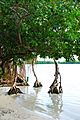
Trees in Salinas
-
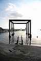
Beach in Salinas
-
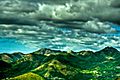
Montes Oscuros
-
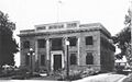
The Town hall building in 1920


_of_the_Municipality_of_Salinas,_Puerto_Rico_(1920)_-_photograph_-_page_151.jpg)
See also
 In Spanish: Salinas (Puerto Rico) para niños
