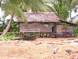
Mabaruma facts for kids
Quick facts for kids
Mabaruma
|
|
|---|---|
|
town and regional capital
|
|
 |
|
| Country | |
| Region | Barima-Waini |
| Elevation | 43 ft (13 m) |
| Population
(2012)
|
|
| • Total | 1,254 |
Mabaruma is an important town in Guyana. It is the main town and capital for Region One, called Barima-Waini. Mabaruma is found near the Aruka River, which is close to the border with Venezuela. The town sits on a small, flat area that is 13 meters (about 43 feet) above the rainforest around it.
History of Mabaruma
Mabaruma was once a big piece of land owned by the Broomes family. They grew and made products like cocoa there. Later, the Government of Guyana bought some of this land. They wanted to build important government buildings and offices.
Most people living in Mabaruma are Amerindians. Some of the groups include the Arawaks, Caribs, and Warao people. There are also many Afro-Guyanese people. Smaller groups of East Indian, Chinese, and Portuguese people live there too.
Mabaruma became the regional capital because the old capital, Morawhanna, was at risk of flooding. In 2016, Mabaruma officially became a town. It joined with nearby villages like Hosororo and Kumaka.
In 2023, there was a disagreement between Guyana and Venezuela about a border area called Guayana Esequiba. People in Mabaruma held a rally to show their support for Guyana. A government minister, Collin Croal, attended the event. Some people from Mabaruma reportedly moved away because of this situation.
Life in Mabaruma
Mabaruma has several important buildings. There is a guest house for government visitors. You can also find the Mabaruma Post Office, the Mabaruma Hospital, and a police station. The police station handles minor court cases.
The town is home to the region's first secondary school, called North West Secondary School. It was built in 1965. Most people in Mabaruma work as farmers or fishers to earn a living.
Mabaruma's Climate
Mabaruma has a tropical rainforest climate. This means it gets a lot of rain all year round. The weather is usually warm and humid.
| Climate data for Mabaruma (1991–2020) | |||||||||||||
|---|---|---|---|---|---|---|---|---|---|---|---|---|---|
| Month | Jan | Feb | Mar | Apr | May | Jun | Jul | Aug | Sep | Oct | Nov | Dec | Year |
| Record high °C (°F) | 33.6 (92.5) |
33.7 (92.7) |
33.5 (92.3) |
35.0 (95.0) |
35.3 (95.5) |
36.0 (96.8) |
33.7 (92.7) |
35.4 (95.7) |
36.0 (96.8) |
35.3 (95.5) |
34.5 (94.1) |
34.5 (94.1) |
36.0 (96.8) |
| Mean daily maximum °C (°F) | 31.2 (88.2) |
31.0 (87.8) |
31.4 (88.5) |
31.6 (88.9) |
31.2 (88.2) |
30.7 (87.3) |
31.1 (88.0) |
31.4 (88.5) |
32.0 (89.6) |
32.1 (89.8) |
31.5 (88.7) |
31.2 (88.2) |
31.4 (88.5) |
| Daily mean °C (°F) | 26.5 (79.7) |
26.4 (79.5) |
26.7 (80.1) |
26.9 (80.4) |
26.7 (80.1) |
26.5 (79.7) |
26.7 (80.1) |
27.0 (80.6) |
27.3 (81.1) |
27.2 (81.0) |
26.8 (80.2) |
26.7 (80.1) |
26.8 (80.2) |
| Mean daily minimum °C (°F) | 21.7 (71.1) |
21.6 (70.9) |
22.0 (71.6) |
22.3 (72.1) |
22.2 (72.0) |
22.2 (72.0) |
22.3 (72.1) |
22.4 (72.3) |
22.5 (72.5) |
22.3 (72.1) |
22.2 (72.0) |
21.9 (71.4) |
22.1 (71.8) |
| Record low °C (°F) | 17.5 (63.5) |
19.0 (66.2) |
19.3 (66.7) |
18.4 (65.1) |
17.4 (63.3) |
19.5 (67.1) |
19.0 (66.2) |
20.0 (68.0) |
19.7 (67.5) |
18.4 (65.1) |
18.0 (64.4) |
17.0 (62.6) |
17.0 (62.6) |
| Average precipitation mm (inches) | 181.8 (7.16) |
100.4 (3.95) |
88.0 (3.46) |
111.0 (4.37) |
260.1 (10.24) |
327.7 (12.90) |
298.8 (11.76) |
213.2 (8.39) |
153.6 (6.05) |
213.2 (8.39) |
239.6 (9.43) |
260.0 (10.24) |
2,447.4 (96.35) |
| Average precipitation days (≥ 1.0 mm) | 14 | 11 | 10 | 9 | 18 | 22 | 21 | 17 | 14 | 16 | 18 | 18 | 188.3 |
| Source: NOAA | |||||||||||||
See also
 In Spanish: Mabaruma para niños
 | Sharif Bey |
 | Hale Woodruff |
 | Richmond Barthé |
 | Purvis Young |


