Machias Bay facts for kids
Quick facts for kids Machias Bay |
|
|---|---|
| Location | Washington County, Maine, United States |
| Coordinates | 44°38′N 67°20′W / 44.64°N 67.33°W |
| Part of | Gulf of Maine |
| River sources | Machias River |
| Max. length | 7 miles (11 km) |
| Max. width | 4 miles (6.4 km) |
| Surface elevation | 0 feet (0 m) |
| Islands | Cross Island |
| Settlements | Machias, Machiasport |
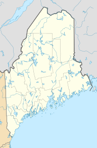
Machias Bay is a beautiful bay located in Washington County, Maine. It connects directly to the larger Gulf of Maine. This bay is famous for being the site of the very first naval battle of the American Revolution.
Contents
Discovering Machias Bay
Machias Bay is a significant natural feature in eastern Maine. It is known for its history and its natural beauty. The bay is a popular spot for fishing and boating.
Where is Machias Bay Located?
Machias Bay is found in the eastern part of Maine. It sits right at the mouth of the Machias River. Several towns are located around its shores. These include Machiasport, Machias, East Machias, Whiting, and Cutler.
To the east, the Cutler Peninsula separates Machias Bay from Little Machias Bay. To the west, the Point of Maine separates it from Little Kennebec Bay. In the south, Cross Island and the Libby Islands mark its opening to the Gulf of Maine.
How Big is Machias Bay?
Machias Bay is a good size for exploring. It stretches about 7 miles (12 kilometers) long. At its widest point, the bay measures about 4 miles (6 kilometers) across.
The Battle of Machias
Machias Bay holds an important place in American history. It was the location of the very first naval battle of the American Revolution. This happened in June 1775, even before the Declaration of Independence was signed.
Why the Battle Happened
The British needed a lot of lumber for their troops in Boston. They sent a ship called the Margaretta to Machias to get some. However, the people of Machias were not happy with British rule. They decided to take action.
A group of local patriots, led by Jeremiah O'Brien, decided to capture the British ship. They used a small, armed merchant ship called the Unity. The patriots chased the Margaretta into Machias Bay. After a short but fierce fight, the Americans captured the British ship. This event showed that the American colonists were ready to fight for their freedom, even on the water. It was a brave act that inspired others.
 | John T. Biggers |
 | Thomas Blackshear |
 | Mark Bradford |
 | Beverly Buchanan |


