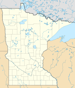
Madison Lake (Minnesota) facts for kids
Quick facts for kids Madison Lake |
|
|---|---|
| Location | Blue Earth County, Minnesota |
| Coordinates | 44°11′15″N 93°48′45″W / 44.18750°N 93.81250°W |
| Type | lake |
| Basin countries | United States |
| Surface area | 1,446 acres (5.85 km2) |
| Max. depth | 59 ft (18 m) |
| Shore length1 | 12 mi (19 km) |
| Surface elevation | 1,017 ft (310 m) |
| Islands | 0 |
| Settlements | 0 |
| 1 Shore length is not a well-defined measure. | |
Madison Lake is a beautiful lake located in Le Sueur County, Minnesota. It is sometimes also called Lake Madison. This lake covers a large area of about 1,446 acres (5.85 km2). At its deepest point, the lake goes down 59 feet (18 m).
The lake was named after James Madison, who was an early president of the United States. The city of Madison Lake, Minnesota is right on the northwest side of the lake. For a long time, Madison Lake has been a popular spot for fishing. It is also part of the larger Le Sueur River watershed system.
Understanding Madison Lake's Ice Out Dates
"Ice Out" is a special term for when the ice on a lake completely melts in the spring. For Madison Lake, people have been carefully recording this date since 1927. This long record helps scientists understand how the climate is changing over time.
How Ice Out Data is Collected
The first records of Madison Lake's ice out were kept on a nearby barn from 1927 to 1940. After that, Frank McCabe took over the measurements from 1940 to 1977. Then, local residents Mary and Dennis Buschkowsky continued this important work from 1977 through 2018. Since 2019, their nephew, Steve Schoeb, has been monitoring the lake.
Key Ice Out Records
The earliest date the ice has ever melted on Madison Lake was March 8, 2000. On the other hand, the latest ice out ever recorded was April 30, 2018. As of 2020, the average ice out date for the lake is around April 5 or April 6. These dates show how much the spring weather can change each year.
 | Toni Morrison |
 | Barack Obama |
 | Martin Luther King Jr. |
 | Ralph Bunche |


