Madison Lake, Minnesota facts for kids
Quick facts for kids
Madison Lake
|
|
|---|---|

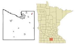
Location of Madison Lake, Minnesota
|
|
| Country | United States |
| State | Minnesota |
| County | Blue Earth |
| Settled | 1871 |
| Platted | January 17, 1885 |
| Incorporated (village) | December 15, 1891 |
| Incorporated (city) | January 5, 1892 |
| Government | |
| • Type | Mayor - Council |
| Area | |
| • Total | 1.36 sq mi (3.53 km2) |
| • Land | 1.35 sq mi (3.50 km2) |
| • Water | 0.01 sq mi (0.03 km2) |
| Elevation | 1,053 ft (321 m) |
| Population
(2020)
|
|
| • Total | 1,247 |
| • Estimate
(2022)
|
1,280 |
| • Density | 921.66/sq mi (355.93/km2) |
| Time zone | UTC-6 (Central) |
| • Summer (DST) | UTC-5 (CDT) |
| ZIP code |
56063
|
| Area code(s) | 507 |
| FIPS code | 27-39320 |
| GNIS feature ID | 2395811 |
Madison Lake is a small city in Blue Earth County, Minnesota, United States. It's right next to the northwest shore of Madison Lake, which is where the city gets its name. In 2020, about 1,247 people lived here. Madison Lake is also part of the larger Mankato-North Mankato area, which is a group of cities and towns that are connected.
Contents
History of Madison Lake
The area where Madison Lake is now was first called Barclay's Addition. In 1881, this land was given to L.S. Barclay. Soon after, it was named Madison Lake. A post office has been open here since 1885. The town got its name from the nearby lake, which was named after President James Madison. The town officially became a village in 1892.
Railroads and Transportation
A railroad line was built to Madison Lake by 1884. It connected the town to Red Wing, Minnesota. This railroad later became part of the Chicago Great Western Railroad. Today, this old railroad path is used as a walking and biking trail. It is now part of the Cannon Valley Trail and Sakatah State Trail.
Big Fire of 1910
On December 23, 1910, a large fire happened in downtown Madison Lake. Four blocks of the city were badly damaged. The fire caused a lot of loss, estimated at $100,000 at that time.
Geography and Location
Madison Lake is a small city in terms of size. It covers about 1.04 square miles (2.69 square kilometers). Most of this area is land, with a small part being water.
Minnesota State Highway 60 is a main road that goes through the city. U.S. Route 14 is also close by. These roads help people travel to and from Madison Lake.
People of Madison Lake
| Historical population | |||
|---|---|---|---|
| Census | Pop. | %± | |
| 1900 | 300 | — | |
| 1910 | 335 | 11.7% | |
| 1920 | 359 | 7.2% | |
| 1930 | 365 | 1.7% | |
| 1940 | 377 | 3.3% | |
| 1950 | 357 | −5.3% | |
| 1960 | 477 | 33.6% | |
| 1970 | 587 | 23.1% | |
| 1980 | 592 | 0.9% | |
| 1990 | 643 | 8.6% | |
| 2000 | 837 | 30.2% | |
| 2010 | 1,017 | 21.5% | |
| 2020 | 1,247 | 22.6% | |
| 2022 (est.) | 1,280 | 25.9% | |
| U.S. Decennial Census 2020 Census |
|||
The city's population has grown over the years. In 1900, about 300 people lived here. By 2020, the population had grown to 1,247 people. In 2022, it was estimated to be around 1,280 people.
Population Details (2010)
In 2010, there were 1,017 people living in Madison Lake. There were 394 households, which are groups of people living together. About 37.8% of these households had children under 18.
The average age of people in the city was 33.3 years old. About 26.2% of the residents were under 18. The population was split evenly between males and females.
Protecting Madison Lake
The Madison Lake Watershed and Lake Association is a group that works to protect the lake. A watershed is the area of land that drains into a lake or river. This group wants to keep Madison Lake healthy for the future.
They teach people about how to protect the lake. They also work to improve the water quality. Their goal is to make sure the lake and its surrounding area stay healthy.
See also
In Spanish: Madison Lake (Minnesota) para niños
 | Jewel Prestage |
 | Ella Baker |
 | Fannie Lou Hamer |

