Maio, Cape Verde facts for kids
|
Native name:
Djarmai
|
|
|---|---|
 |
|
 |
|
| Geography | |
| Location | Atlantic Ocean |
| Coordinates | 15°13′N 23°10′W / 15.217°N 23.167°W |
| Area | 274.5 km2 (106.0 sq mi) |
| Length | 24.1 km (14.98 mi) |
| Width | 16.3 km (10.13 mi) |
| Highest elevation | 436 m (1,430 ft) |
| Highest point | Monte Penoso |
| Administration | |
| Municipality | Maio |
| Largest settlement | Porto Inglês |
| Demographics | |
| Demonym | Maiense |
| Population | 6980 (2015) |
| Pop. density | 25.4 /km2 (65.8 /sq mi) |
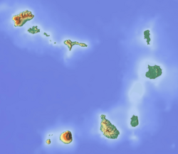
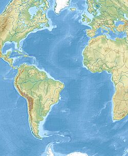
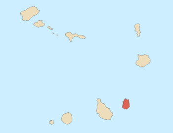
Maio is a beautiful island in Cape Verde, a country made up of many islands in the Atlantic Ocean. It's the most eastern island in the group called the Sotavento Islands. Maio is found south of Boa Vista Island and east of Santiago Island. The whole island is one special area called a municipality, which is like a local government district.
Contents
History of Maio Island
Maio Island was found in the year 1460. People started living there in the late 1500s. They used the land to raise animals, especially goats.
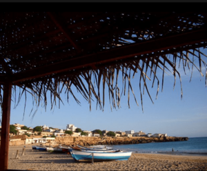
In the 1600s, people began collecting salt, which helped the island's population grow. The English shipped salt from a town called Porto Inglês to Europe. That's why the town is named "English Port."
A battle happened near Maio's southern coast in 1814. It was between British and French warships during the Napoleonic Wars. Many people left Maio in the 1900s because of long periods of dry weather.
Geography and Landscapes of Maio
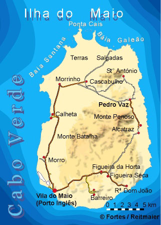
Maio Island covers an area of about 274.5 square kilometers. It is about 24.1 kilometers long and 16.3 kilometers wide. The tallest point on the island is a mountain called Monte Penoso, which is 436 meters high. It's located near the east coast.
In the far north of the island, there is a salty flat area known as Terras Salgadas. The northernmost tip of Maio is called Ponta Cais. A good part of the island, about 20%, is covered by forests. Also, 28% of the island is a protected area, meaning it's kept safe for nature.
Maio has several bays, like Baía do Galeão and Baía da Santana in the north. In the southeast, you'll find a lagoon named Lagoa Cimidor. There's also a small, uninhabited island called Ilhéu Laje Branca close to Maio's north coast. The main town on Maio is Porto Inglês, and the island's airport, Maio Airport, is located nearby.
Maio's Municipality and Towns
The entire island of Maio is part of one local government area, called the Concelho do Maio. This municipality has one main area, or freguesia, called Nossa Senhora da Luz, which covers the whole island.
This freguesia is divided into several smaller towns and settlements:
- Alcatraz
- Barreiro (town)
- Calheta (town)
- Cascabulho
- Figueira
- Morro
- Morrinho
- Pedro Vaz
- Pilão Cão
- Porto Inglês (city)
- Praia Gonçalo
- Ribeira Dom João
- Santo António
Population of Maio
In the 1830s, about 2,500 people lived on Maio. Today, most people living on the island are Roman Catholic. The population has grown over the years, as you can see in the chart below.
| Year | Population |
|---|---|
| 1940 |
2,237
|
| 1950 |
1,924
|
| 1960 |
2,680
|
| 1970 |
3,466
|
| 1980 |
4,098
|
| 1990 |
4,969
|
| 2000 |
6,742
|
| 2010 |
6,952
|
| 2015 |
6,980
|
Maio's Economy and Resources
When people first settled on Maio, the island's economy grew around collecting salt. There was also some agriculture (farming) and grazing (raising animals).
Farmers on Maio practice two types of agriculture. During the rainy season, they grow crops like corn, beans, pumpkins, and melons. All year round, they cultivate sweet potatoes, cassava, papaya, figs, coconuts, and tamarind. Many families on the island have goats, cows, pigs, chickens, and donkeys. Horses are not as common. A big challenge for the people of Maio is the lack of water.
Fishing is also a very important activity on the island. Fishermen catch many types of fish, including tuna, sailfish, and different kinds of coral fish. The economy of Maio also gets a lot of support from people who have moved away but send money back to their families on the island.
Sports on Maio Island
Football (soccer) is the most popular sport on Maio. However, other sports like basketball and futsal are becoming more popular. Water sports such as surfing, diving, and swimming are also gaining interest among the islanders.
Notable People from Maio
- Maria Helena da Costa Dias, a writer and translator from Cape Verde who lived in Portugal.
- Edy Tavares, a professional basketball player.
- Horace Silver, a famous jazz pianist, composer, and arranger.
See also
 In Spanish: Isla de Maio para niños
 | Audre Lorde |
 | John Berry Meachum |
 | Ferdinand Lee Barnett |


