
Malezas facts for kids
Quick facts for kids
Malezas
|
|
|---|---|
|
Barrio
|
|

Location of Malezas within the municipality of Mayagüez shown in red
|
|

Malezas
Location in Caribbean
|
|
| Commonwealth | |
| Municipality | |
| Area | |
| • Total | 1.06 sq mi (2.7 km2) |
| • Land | 1.06 sq mi (2.7 km2) |
| • Water | 0 sq mi (0 km2) |
| Elevation | 335 ft (102 m) |
| Population
(2010)
|
|
| • Total | 1,072 |
| • Density | 1,011.3/sq mi (390.5/km2) |
| Source: 2010 Census | |
| Time zone | UTC−4 (AST) |
Malezas is a small community, also known as a barrio, located in the city of Mayagüez, Puerto Rico. It's like a neighborhood or district within a larger city. In 2010, about 1,072 people lived in Malezas. It covers an area of about 1.06 square miles.
History of Malezas
Puerto Rico became a territory of the United States after the Spanish–American War in 1898. This change happened because of an agreement called the Treaty of Paris of 1898.
In 1899, the United States government took a special count of all the people in Puerto Rico. This count is called a census. The census found that the combined population of Malezas and a nearby area called Río Hondo was 1,072 people.
Population Changes Over Time
The number of people living in Malezas has changed over many years. Here's how the population has looked according to different censuses:
| Historical population | |||
|---|---|---|---|
| Census | Pop. | %± | |
| 1980 | 959 | — | |
| 1990 | 682 | −28.9% | |
| 2000 | 1,143 | 67.6% | |
| 2010 | 1,072 | −6.2% | |
| U.S. Decennial Census 1899 (shown as 1900) 1910-1930 1930-1950 1980-2000 2010 |
|||
Images for kids
-
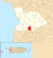
This map shows where Malezas is located within Mayagüez.
See also
 In Spanish: Malezas (Mayagüez) para niños
- List of communities in Puerto Rico
