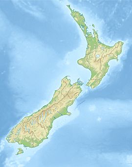
Mangamaire River facts for kids
Quick facts for kids Mangamaire River |
|
|---|---|
| Native name | Mangamaire |
| Country | New Zealand |
| Region | Manawatū-Whanganui |
| District | Rangitikei |
| Physical characteristics | |
| Main source | Kaimanawa Range 1,360 m (4,460 ft) 39°6′32″S 176°3′25″E / 39.10889°S 176.05694°E |
| River mouth | Rangitīkei River 790 m (2,590 ft) 39°16′59″S 176°0′14″E / 39.28306°S 176.00389°E |
| Length | 29 km (18 mi) |
| Basin features | |
| Progression | Mangamaire River → Rangitīkei River |
| River system | Rangitīkei River |
| Tributaries |
|
The Mangamaire River is a river found in the middle of New Zealand's North Island. It's an important part of the Rangitikei River system. The Mangamaire River flows for about 29 kilometers (18 miles).
This river starts in the Kaimanawa Range mountains. It then flows towards the southwest. For much of its journey, it forms part of the edge of the Kaimanawa Forest Park. The Mangamaire River eventually joins the larger Rangitikei River. This meeting point is in a hilly area, about 40 kilometers (25 miles) east of Mount Ruapehu.
What Does the Name Mean?
The name Mangamaire comes from the Maori language. The New Zealand Ministry for Culture and Heritage explains its meaning. It translates to "maire stream."
- Manga means "stream" or "river."
- Maire refers to a type of native New Zealand tree. These trees are known for their strong wood.
So, the name tells us that this river flows through an area where maire trees might be found.
Where is the Mangamaire River?
The Mangamaire River is located in the Manawatū-Whanganui region of New Zealand. This region is in the lower part of the North Island. The river is specifically within the Rangitikei District.
- Source: The river begins high up in the Kaimanawa Range. This mountain range is known for its forests and rugged land.
- Mouth: It flows into the Rangitīkei River. The Rangitikei is one of the longest rivers in the North Island.
The Mangamaire River is considered one of the "headwaters" of the Rangitikei. This means it's one of the smaller streams that come together to form the beginning of the bigger river.
River Journey
The Mangamaire River starts at an elevation of about 1,360 meters (4,460 feet). This is quite high up in the mountains. As it flows, it drops down to an elevation of about 790 meters (2,590 feet) where it joins the Rangitikei River.
Along its path, the river is fed by smaller streams. These include the Mangatawai Stream and the Te Piri Stream. These smaller streams add water to the Mangamaire, making it bigger as it flows. The river's journey through the Kaimanawa Forest Park means it passes through beautiful natural areas.
 | John T. Biggers |
 | Thomas Blackshear |
 | Mark Bradford |
 | Beverly Buchanan |


