Mangapu River facts for kids
Quick facts for kids Mangapu River |
|
|---|---|

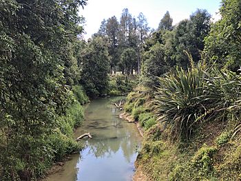
Mangapu River from Pehitawa bridge
|
|
| Country | New Zealand |
| Physical characteristics | |
| River mouth | Waipa River |
| Length | 48 km (30 mi) |
The Mangapu River is a river found in the Waikato region of New Zealand's North Island. It starts from many small streams that flow north from the King Country area, south of Te Kuiti. The longest of these streams is called the Mangaokewa Stream. These streams all join together to form the Mangapu River near Te Kuiti. From there, the river flows north, passing close to the famous Waitomo Caves. The Mangapu caves in this area have the biggest entrance in the North Island, which is about 100 m (330 ft) long and 90 m (300 ft) deep! The Mangapu River then flows into the Waipa River at a town called Otorohanga.
The name Mangapū means "double stream" in Māori. This name was given by the New Zealand Ministry for Culture and Heritage.
You can cross the Mangapu River on State Highway 3. There's a bridge near Otorohanga that is 111 m (364 ft) long, built in 1966. Another concrete bridge, 41 m (135 ft) long, was built in 1977 near Hangatiki. The main railway line for the North Island, called the North Island Main Trunk, runs alongside the river for about 6 km (3.7 mi). Sometimes, the river can flood, as it did in 1905.
Scientists check the health of the river at Otorohanga. They have found that the water quality needs improvement. It is currently in the lowest 25% for pollution compared to similar rivers. However, people are working hard to clean up the river and make it healthier for everyone.
Pehitawa Kahikatea Forest Reserve
The Pehitawa Kahikatea Forest Reserve is a special place located on the east bank of the Mangapu River. It covers about 18.5 ha (46 acres) of land. This reserve is home to a type of native New Zealand tree called kahikatea. The Native Forests Restoration Trust bought this land in 2001 to protect it.
Long ago, kahikatea forests covered a huge area in the Waipa region, about 41,000 ha (100,000 acres). Today, only a small part of these forests remains, about 158 ha (390 acres). In the Mangapu valley, there are only about 52 ha (130 acres) left. Sadly, over 70 ha (170 acres) of this forest was cut down since 1975.
In the 1930s, a big project was done upstream from the reserve to drain the land, which even emptied a lake. The forest often floods in winter, but protecting it from floods would be too expensive. Some of the kahikatea trees in the reserve are very old, about 120 years!
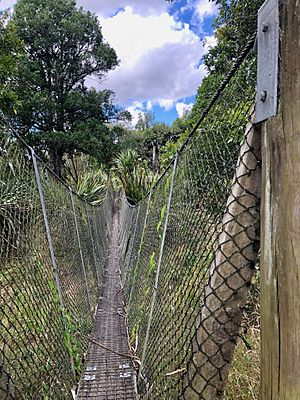
Besides kahikatea, you can also find other native trees here, like swamp maire, matai, titoki, and pukatea. The famous Te Araroa long-distance walking trail goes right through this reserve. Walkers can cross the Mangapu River using a cool suspension bridge here.
 | Selma Burke |
 | Pauline Powell Burns |
 | Frederick J. Brown |
 | Robert Blackburn |


