Mansfield, South Dakota facts for kids
Quick facts for kids
Mansfield, South Dakota
|
|
|---|---|
| Country | United States |
| State | South Dakota |
| Counties | Brown, Spink |
| Area | |
| • Total | 2.41 sq mi (6.24 km2) |
| • Land | 2.41 sq mi (6.24 km2) |
| • Water | 0.00 sq mi (0.00 km2) |
| Elevation | 1,286 ft (392 m) |
| Population
(2020)
|
|
| • Total | 86 |
| • Density | 35.67/sq mi (13.77/km2) |
| Time zone | UTC-6 (Central (CST)) |
| • Summer (DST) | UTC-5 (CDT) |
| ZIP code |
57460
|
| Area code(s) | 605 |
| FIPS code | 46-40580 |
| GNIS feature ID | 2628848 |
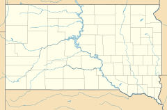
Mansfield is a small community in South Dakota, United States. It's located right on the border between two counties: Brown and Spink.
Even though it's not a city with its own government, it's recognized as a "census-designated place." This means the U.S. Census Bureau counts its population separately. In 2020, only 86 people lived in Mansfield.
Mansfield is about 2 miles (3.2 km) west of Highway 281. It's also about 18 miles (29 km) south of Aberdeen, which is the third-largest city in South Dakota.
The James River flows about 7 miles (11 km) east of Mansfield. The land around the James River is very rich and fertile, making it excellent for farming. This area is also famous for its many types of game animals, especially pheasants, which makes it a popular spot for hunting.
Who Lives in Mansfield?
| Historical population | |||
|---|---|---|---|
| Census | Pop. | %± | |
| 2020 | 86 | — | |
| U.S. Decennial Census | |||
The number of people living in Mansfield is counted during the United States Census. In 2020, the census showed that 86 people called Mansfield home.
A Look Back: Mansfield's History
Mansfield got its name from a man named John Mansfield. He owned the land where the community was built. John Mansfield was also important because he helped bring the railroad to this area. The railroad was a big deal back then, as it helped connect communities and transport goods.
See also
 In Spanish: Mansfield (Dakota del Sur) para niños
 | Selma Burke |
 | Pauline Powell Burns |
 | Frederick J. Brown |
 | Robert Blackburn |


