Manzanola, Colorado facts for kids
Quick facts for kids
Manzanola, Colorado
|
|
|---|---|

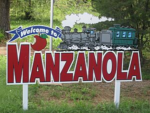
Welcome Sign (2010)
|
|

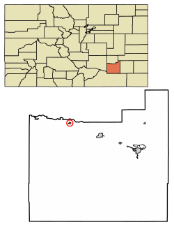
Location of Manzanola in Otero County, Colorado.
|
|
| Country | |
| State | |
| County | Otero |
| Incorporated (town) | July 9, 1900 |
| Government | |
| • Type | Statutory Town |
| Area | |
| • Total | 0.28 sq mi (0.74 km2) |
| • Land | 0.28 sq mi (0.74 km2) |
| • Water | 0.00 sq mi (0.00 km2) |
| Elevation | 4,255 ft (1,297 m) |
| Population
(2020)
|
|
| • Total | 341 |
| • Density | 1,218/sq mi (461/km2) |
| Time zone | UTC-7 (Mountain (MST)) |
| • Summer (DST) | UTC-6 (MDT) |
| ZIP code |
81050
|
| Area code(s) | 719 |
| FIPS code | 08-48500 |
| GNIS feature ID | 0204826 |
Manzanola is a small town in Otero County, Colorado, United States. It is known as a "Statutory Town," which means it follows certain state laws. In 2020, about 341 people lived there.
Contents
About Manzanola
A post office opened in Manzanola in 1895. The town's name comes from a nearby apple orchard. Manzanola is a Spanish word that means "red apple."
Before it was called Manzanola, the town had a few other names. These included the Town of Grams Ranch, the Town of Apishipa, and the Town of Catlin.
Geography of Manzanola
Manzanola is located in Colorado at coordinates 38 degrees, 6 minutes, 33 seconds North and 103 degrees, 52 minutes, 4 seconds West.
The United States Census Bureau says that the town covers about 0.3 square miles (0.74 square kilometers). All of this area is land.
Population Changes Over Time
| Historical population | |||
|---|---|---|---|
| Census | Pop. | %± | |
| 1910 | 428 | — | |
| 1920 | 562 | 31.3% | |
| 1930 | 578 | 2.8% | |
| 1940 | 531 | −8.1% | |
| 1950 | 543 | 2.3% | |
| 1960 | 562 | 3.5% | |
| 1970 | 451 | −19.8% | |
| 1980 | 459 | 1.8% | |
| 1990 | 437 | −4.8% | |
| 2000 | 525 | 20.1% | |
| 2010 | 434 | −17.3% | |
| 2020 | 341 | −21.4% | |
| U.S. Decennial Census | |||
In the year 2000, there were 525 people living in Manzanola. These people lived in 189 households. About 30.2% of these households had children under 18 years old.
The town's population was spread out by age. About 30.7% of the people were under 18. About 14.9% were 65 years old or older. The average age in the town was 33 years.
Transportation
Manzanola is part of Colorado's Bustang network. This is a public transportation system. The town is on the Lamar-Pueblo-Colorado Springs Outrider line. This line helps people travel between these cities.
See also
 In Spanish: Manzanola (Colorado) para niños
 | Frances Mary Albrier |
 | Whitney Young |
 | Muhammad Ali |

