Delmar, Wisconsin facts for kids
Quick facts for kids
Town of Delmar
|
|
|---|---|

Town hall
|
|

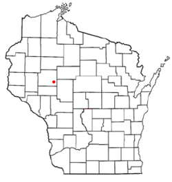
Location of the town of Delmar
|
|
| Country | |
| State | |
| County | Chippewa |
| Area | |
| • Total | 42.6 sq mi (110.3 km2) |
| • Land | 42.4 sq mi (109.8 km2) |
| • Water | 0.2 sq mi (0.5 km2) |
| Elevation | 1,132 ft (345 m) |
| Population
(2010)
|
|
| • Total | 936 |
| • Density | 22/sq mi (8.5/km2) |
| Time zone | UTC-6 (Central (CST)) |
| • Summer (DST) | UTC-5 (CDT) |
| Area code(s) | 715 & 534 |
| FIPS code | 55-19625 |
| GNIS feature ID | 1583072 |
| PLSS township | T29N R5W and part of T29N R6W |
The Town of Delmar is a small community located in Chippewa County, in the state of Wisconsin in the United States. In 2010, about 936 people lived there.
Contents
History of Delmar
Early Surveys and Land
The land that became the Town of Delmar was first measured and mapped in the fall of 1848. This work was done by teams working for the U.S. government. In November 1849, another team marked all the corners of the land sections. They walked through the woods and swamps, using special tools like a chain and a compass to measure.
After their survey, the main surveyor wrote a description of the area. He noted that the southern part of the township had a lot of valuable pine trees. He also mentioned two empty cabins in one section. The land was mostly flat, with poor and wet soil, so not much of it was good for farming.
Rivers and Trees
The surveyor also described the rivers in the area. He said the riverbanks were low and the water flowed quickly. The Yellow River runs through the northwest part of the town. There was also another large stream in the eastern part, which could be a good source of water power. The area was heavily covered with trees like Birch, Maple, Sugar Pine, and Oak.
Geography of Delmar
Location and Size
The Town of Delmar is found in the southeastern part of Chippewa County. It stretches about 6 miles (10 km) from north to south. It is between 7 to 9 miles (11 to 14 km) wide from east to west. To the east, the town shares a border with Clark County.
Nearby Communities
The village of Boyd is located in the southwest part of the town. The city of Stanley is in the southeast. Both Boyd and Stanley are separate from the Town of Delmar itself. The small community of Maple Hill is inside the town. Also, the community of Brownville is partly located in the town.
Land and Water
The United States Census Bureau says that the Town of Delmar covers a total area of about 42.6 square miles (110.3 km2). Most of this area, about 42.4 square miles (109.8 km2), is land. Only a small part, about 0.2 square miles (0.5 km2) or 0.45%, is water.
Population of Delmar
| Historical population | |||
|---|---|---|---|
| Census | Pop. | %± | |
| 1990 | 994 | — | |
| 2000 | 941 | −5.3% | |
| 2010 | 936 | −0.5% | |
| 2020 (est.) | 973 | 4.0% | |
Population Changes
In the year 2000, there were 941 people living in the town. These people lived in 314 households, and 252 of these were families. The town had about 21.9 people per square mile (8.5/km2). Most of the people living in Delmar were White (98.72%). A small number were African American or Native American.
Households and Families
Many households in Delmar had children under 18 living with them (39.5%). Most households were married couples living together (70.7%). About 16.2% of all households were made up of people living alone. The average household had 3 people, and the average family had about 3.39 people.
Age Groups
The population of Delmar included people of all ages. About 31.9% of the people were under 18 years old. About 11.6% were 65 years old or older. The average age in the town was 36 years.
Education in Delmar
Students in the Town of Delmar attend schools in two different school districts. These are the School District of Cadott Community and the Stanley-Boyd Area School District.
See also
 In Spanish: Delmar (Wisconsin) para niños

