Marilla, New York facts for kids
Quick facts for kids
Marilla, New York
|
|
|---|---|

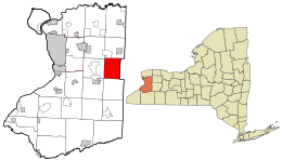
Location in Erie County and the state of New York.
|
|

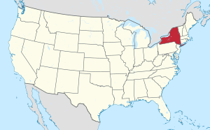
Location of New York in the United States
|
|
| Country | United States |
| State | New York |
| County | Erie County |
| Incorporated | 1853 |
| Named for | Marilla Rogers |
| Area | |
| • Total | 27.54 sq mi (71.34 km2) |
| • Land | 27.50 sq mi (71.24 km2) |
| • Water | 0.04 sq mi (0.10 km2) |
| Elevation | 915 ft (279 m) |
| Population
(2020)
|
|
| • Total | 5,189 |
| • Density | 195.06/sq mi (75.31/km2) |
| Time zone | UTC-5 (EST) |
| • Summer (DST) | UTC-4 (EDT) |
| ZIP code |
14102
|
| Area code(s) | 716 |
| FIPS code | 36-029-45601 |
| FIPS code | 36-45601 |
| GNIS feature ID | 0979198 |
Marilla is a small town in Erie County, New York, in the United States. In 2020, about 5,189 people lived there. The town was named after a special person, Marilla Rogers, who was an early school teacher.
Contents
History of Marilla
The area where Marilla is located was first settled around 1827. At that time, this land was part of the Buffalo Creek Reservation. This was land set aside for the Seneca people.
The first settlers here were members of a group called the Ebenezer Society. They moved onto these Seneca lands. The land officially opened up for more general settlement after a special agreement called the Treaty of Buffalo Creek was finished in 1842.
The town of Marilla was officially created in 1853. It was formed from parts of two other towns: Alden and Wales. The town got its name from Marilla Rogers, who was a school teacher in the area. She passed away in 1855, just two years after the town was named after her.
One of the oldest buildings in town is the historic Marilla General Store. It is located on Two Rod Road and is now known as the Marilla Country Store.
Geography of Marilla
Marilla covers a total area of about 71.34 square kilometers (27.54 square miles). Most of this area, about 71.24 square kilometers (27.50 square miles), is land. Only a small part, about 0.10 square kilometers (0.04 square miles), is water.
Two important streams flow through the town. Buffalo Creek runs through the southwestern part of Marilla. Cayuga Creek flows through the northeastern part of the town.
Neighboring Towns
Marilla shares its borders with several other towns:
- Alden to the north
- Lancaster to the northwest
- Elma to the west
- Aurora to the southwest
- Wales to the south
- Bennington in Wyoming County to the east
Main Roads in Marilla
 New York State Route 354 (also called Clinton Street) is a major road. It runs from east to west through the northern part of the town, connecting Elma to Bennington.
Population Changes in Marilla
| Historical population | |||
|---|---|---|---|
| Census | Pop. | %± | |
| 1860 | 1,596 | — | |
| 1870 | 1,804 | 13.0% | |
| 1880 | 1,825 | 1.2% | |
| 1890 | 1,590 | −12.9% | |
| 1900 | 1,441 | −9.4% | |
| 1910 | 1,382 | −4.1% | |
| 1920 | 1,237 | −10.5% | |
| 1930 | 1,282 | 3.6% | |
| 1940 | 1,364 | 6.4% | |
| 1950 | 1,482 | 8.7% | |
| 1960 | 2,252 | 52.0% | |
| 1970 | 3,250 | 44.3% | |
| 1980 | 4,861 | 49.6% | |
| 1990 | 5,250 | 8.0% | |
| 2000 | 5,709 | 8.7% | |
| 2010 | 5,327 | −6.7% | |
| 2020 | 5,189 | −2.6% | |
| U.S. Decennial Census | |||
The population of Marilla has changed quite a bit over the years. In 1860, about 1,596 people lived here. The number of residents slowly grew until the 1950s. After that, the population started to grow much faster.
By the year 2000, Marilla had its highest population with 5,709 people. Since then, the population has decreased slightly. In 2020, about 5,189 people lived in the town.
Communities and Places in Marilla
Marilla is home to several smaller communities and important locations:
- Buffalo Creek – This is a stream that flows westward through the southern part of the town.
- Bush Gardens – A small community, called a hamlet, located in the northeastern part of Marilla.
- Marilla (hamlet) – This is the main hamlet in the northwestern part of the town. It is found along Buffalo Creek where Two Rod and Bullis Roads meet. This community was started around 1829.
- Porterville – A hamlet in the southwestern corner of the town. It is also located on Buffalo Creek. This community was named after Archibald Porter, who operated an early mill there.
- Williston – This location is near where Williston and Three Rod roads meet. It was named after the Willis family, who were early settlers in the area.
Schools in Marilla
Students living in Marilla attend schools that are part of either the Iroquois Central School District or the Alden Central School District. Both of these school districts are known for being good schools in the Western New York area.
Marilla Primary is a school for younger students (Kindergarten through 4th grade). It is part of the Iroquois School District and is located in Marilla on Bullis Road. The Iroquois School District has about 3,000 students in total. It has three separate primary schools, one intermediate school (for 5th grade), a middle school (for 6th to 8th grade), and a high school (for 9th to 12th grade).
The primary schools are in different towns, like Elma Primary, Marilla Primary, and Wales Primary. The middle school and high school are on a large campus in Elma. These schools have their own gymnasiums, cafeterias, libraries, and offices. The school district also has lots of open space around the schools for students to play and participate in activities.
See also
 In Spanish: Marilla (Nueva York) para niños
 | Kyle Baker |
 | Joseph Yoakum |
 | Laura Wheeler Waring |
 | Henry Ossawa Tanner |

