
Wales, New York facts for kids
Quick facts for kids
Wales
|
|
|---|---|
| Town of Wales | |

County Route 175 eastbound entering Wales.
|
|
| Motto(s):
"Great Country Living" |
|

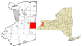
Location in Erie County and the state of New York.
|
|
| Country | United States |
| State | New York |
| County | Erie |
| Named for | Wales |
| Government | |
| • Type | Town Council |
| Area | |
| • Total | 35.64 sq mi (92.30 km2) |
| • Land | 35.59 sq mi (92.17 km2) |
| • Water | 0.05 sq mi (0.13 km2) |
| Elevation | 1,335 ft (407 m) |
| Population
(2010)
|
|
| • Total | 3,005 |
| • Estimate
(2016)
|
3,018 |
| • Density | 84.81/sq mi (32.74/km2) |
| Time zone | UTC-5 (Eastern (EST)) |
| • Summer (DST) | UTC-4 (EDT) |
| FIPS code | 36-029-77871 |
| GNIS feature ID | 0979591 |
Wales is a small town located in Erie County, New York, United States. It's part of the "Southtowns" area, which means it's in the southeastern part of Erie County, southeast of the city of Buffalo. In 2010, about 3,005 people lived in Wales.
Contents
The History of Wales, New York
How Wales Was Formed
The town of Wales was officially created in 1818. It was formed from a larger area that was once part of the town of Willink.
Why the Name Wales?
The town got its name because its rolling hills and green fields reminded the early settlers of the country of Wales in the United Kingdom.
Life in Early Wales
Originally, Wales was mostly a farming community. Over the years, the town has grown, but it has kept its small-town feel. Leaders in Wales have worked to make sure the town stays a great place to live, with a focus on small, family-friendly businesses. People in Wales are known for helping each other and volunteering in their community.
Geography of Wales
Where is Wales Located?
Wales covers a total area of about 35.64 square miles (92.3 square kilometers). Most of this area is land, with only a tiny bit being water. The eastern border of the town is also the border of Wyoming County.
Major Roads in Wales
New York State Route 400 is an important road that goes through the southwestern part of the town.
Climate in Wales
Understanding Wales' Weather
Wales has a type of climate called a warm-summer humid continental climate. This means it has warm summers and cold, snowy winters. The weather here is often described as "Dfb" on climate maps.
Temperature Extremes in Wales
The hottest temperature ever recorded in Wales was 95°F (35°C). This happened on July 10, 2020, and again on July 17, 2022. The coldest temperature ever recorded was a very chilly -19°F (-28°C). This low temperature was recorded on December 13, 1988, and again on February 14–15, 2016.
| Climate data for Wales, New York, 1991–2020 normals, extremes 1949–present | |||||||||||||
|---|---|---|---|---|---|---|---|---|---|---|---|---|---|
| Month | Jan | Feb | Mar | Apr | May | Jun | Jul | Aug | Sep | Oct | Nov | Dec | Year |
| Record high °F (°C) | 66 (19) |
72 (22) |
82 (28) |
89 (32) |
92 (33) |
92 (33) |
95 (35) |
94 (34) |
90 (32) |
84 (29) |
79 (26) |
68 (20) |
95 (35) |
| Mean maximum °F (°C) | 55.7 (13.2) |
54.3 (12.4) |
65.6 (18.7) |
78.9 (26.1) |
83.3 (28.5) |
86.6 (30.3) |
87.7 (30.9) |
86.8 (30.4) |
84.9 (29.4) |
77.3 (25.2) |
67.8 (19.9) |
57.0 (13.9) |
89.3 (31.8) |
| Mean daily maximum °F (°C) | 31.5 (−0.3) |
33.1 (0.6) |
41.6 (5.3) |
55.3 (12.9) |
67.0 (19.4) |
74.9 (23.8) |
78.8 (26.0) |
77.7 (25.4) |
71.6 (22.0) |
59.5 (15.3) |
47.4 (8.6) |
36.7 (2.6) |
56.3 (13.5) |
| Daily mean °F (°C) | 23.4 (−4.8) |
24.2 (−4.3) |
31.9 (−0.1) |
44.2 (6.8) |
55.7 (13.2) |
64.5 (18.1) |
68.4 (20.2) |
67.1 (19.5) |
60.7 (15.9) |
49.7 (9.8) |
39.1 (3.9) |
29.5 (−1.4) |
46.5 (8.1) |
| Mean daily minimum °F (°C) | 15.4 (−9.2) |
15.2 (−9.3) |
22.2 (−5.4) |
33.1 (0.6) |
44.2 (6.8) |
54.0 (12.2) |
57.9 (14.4) |
56.5 (13.6) |
49.7 (9.8) |
39.8 (4.3) |
30.8 (−0.7) |
22.3 (−5.4) |
36.8 (2.6) |
| Mean minimum °F (°C) | −7.1 (−21.7) |
−4.3 (−20.2) |
2.6 (−16.3) |
20.6 (−6.3) |
29.9 (−1.2) |
39.7 (4.3) |
46.6 (8.1) |
45.1 (7.3) |
35.8 (2.1) |
26.2 (−3.2) |
14.9 (−9.5) |
3.6 (−15.8) |
−10.2 (−23.4) |
| Record low °F (°C) | −18 (−28) |
−19 (−28) |
−12 (−24) |
9 (−13) |
25 (−4) |
31 (−1) |
40 (4) |
35 (2) |
26 (−3) |
21 (−6) |
0 (−18) |
−19 (−28) |
−19 (−28) |
| Average precipitation inches (mm) | 3.56 (90) |
2.65 (67) |
3.16 (80) |
3.58 (91) |
3.50 (89) |
4.15 (105) |
3.94 (100) |
3.48 (88) |
3.93 (100) |
4.18 (106) |
4.05 (103) |
3.90 (99) |
44.08 (1,118) |
| Average snowfall inches (cm) | 32.9 (84) |
19.9 (51) |
17.0 (43) |
3.6 (9.1) |
0.0 (0.0) |
0.0 (0.0) |
0.0 (0.0) |
0.0 (0.0) |
0.0 (0.0) |
0.2 (0.51) |
9.1 (23) |
26.6 (68) |
109.3 (278.61) |
| Average extreme snow depth inches (cm) | 15.9 (40) |
13.6 (35) |
12.0 (30) |
2.7 (6.9) |
0.0 (0.0) |
— | — | — | 0.0 (0.0) |
0.2 (0.51) |
7.3 (19) |
11.1 (28) |
19.7 (50) |
| Average precipitation days (≥ 0.01 in) | 18.2 | 14.6 | 13.3 | 13.5 | 12.3 | 12.2 | 11.1 | 10.5 | 10.6 | 12.9 | 13.4 | 16.7 | 159.3 |
| Average snowy days (≥ 0.1 in) | 13.2 | 11.0 | 7.1 | 2.2 | 0.0 | 0.0 | 0.0 | 0.0 | 0.0 | 0.1 | 4.1 | 10.1 | 47.8 |
| Source 1: NOAA | |||||||||||||
| Source 2: National Weather Service | |||||||||||||
Population and People of Wales
How Many People Live in Wales?
| Historical population | |||
|---|---|---|---|
| Census | Pop. | %± | |
| 1820 | 903 | — | |
| 1830 | 1,500 | 66.1% | |
| 1840 | 1,987 | 32.5% | |
| 1850 | 2,124 | 6.9% | |
| 1860 | 1,710 | −19.5% | |
| 1870 | 1,416 | −17.2% | |
| 1880 | 1,302 | −8.1% | |
| 1890 | 1,200 | −7.8% | |
| 1900 | 1,220 | 1.7% | |
| 1910 | 1,203 | −1.4% | |
| 1920 | 985 | −18.1% | |
| 1930 | 1,086 | 10.3% | |
| 1940 | 1,198 | 10.3% | |
| 1950 | 1,370 | 14.4% | |
| 1960 | 1,910 | 39.4% | |
| 1970 | 2,617 | 37.0% | |
| 1980 | 2,844 | 8.7% | |
| 1990 | 2,917 | 2.6% | |
| 2000 | 2,960 | 1.5% | |
| 2010 | 3,005 | 1.5% | |
| 2020 | 3,009 | 0.1% | |
| U.S. Decennial Census | |||
According to the 2020 census, the town of Wales had a population of 3,009 people. This means there were about 84.8 people living in every square mile.
Who Lives in Wales?
In 2000, there were 2,960 people living in Wales. Most residents were White (98.58%). A small number of people were African American, Native American, or Asian. About 0.74% of the population was Hispanic or Latino.
Households and Families
There were 1,116 households in Wales in 2000. About 34.6% of these households had children under 18 living there. Most households (64.3%) were married couples. The average household had 2.65 people, and the average family had 3.07 people.
Age Groups in Wales
The population in Wales is spread across different age groups. About 24.9% of the people were under 18 years old. The median age was 39 years old. This means half the people were younger than 39 and half were older.
Income in Wales
In 2000, the average income for a household in Wales was $51,486. For families, the average income was $59,350. A small percentage of families (2.1%) and people (3.6%) lived below the poverty line.
Notable People from Wales
- Alice Moore Hubbard – An American writer and feminist.
- John James Knowlton – A former politician in Wisconsin.
- Wally Schang – A famous baseball catcher who played from 1913 to 1931. Schang Road in Wales is named after him!
- Adoniram J. Warner – A former US Congressman and a Union Army General during the American Civil War.
Communities and Places in Wales
- Buffalo Creek – A stream that flows north through the town.
- Colgrave – A specific spot on Centerline Road in the western part of Wales.
- Goodleburg Cemetery – An old cemetery located in the town that is no longer used.
- South Wales – A small community (called a hamlet) located where Wales meets the town of Aurora. This is where the Gow School is located.
- Wales Center – A hamlet located near the northern border of the town.
- Wales Hollow (also known as "Woods Hollow") – Another location near the western edge of the town.
Images for kids
-

County Route 175 eastbound entering Wales.
-
Location in Erie County and the state of New York.
See also
 In Spanish: Wales (Nueva York) para niños
