Markle, Indiana facts for kids
Quick facts for kids
Markle, Indiana
|
|
|---|---|

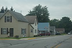
Logan Street residential area
|
|

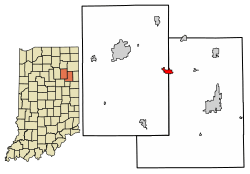
Location of Markle in Huntington County and Wells County, Indiana.
|
|
| Country | |
| State | |
| Counties | Huntington, Wells |
| Township | Rock Creek (Huntington County), Union (Huntington County), Rockcreek (Wells County), Union (Wells County) |
| Area | |
| • Total | 1.43 sq mi (3.69 km2) |
| • Land | 1.37 sq mi (3.56 km2) |
| • Water | 0.05 sq mi (0.14 km2) |
| Elevation | 807 ft (246 m) |
| Population
(2020)
|
|
| • Total | 1,071 |
| • Density | 780.04/sq mi (301.16/km2) |
| Time zone | UTC-5 (Eastern (EST)) |
| • Summer (DST) | UTC-4 (EDT) |
| ZIP code |
46770
|
| Area code(s) | 260 |
| FIPS code | 18-47160 |
| GNIS feature ID | 2396736 |
Markle is a small town located in the state of Indiana, in the United States. It is split between two counties: Huntington County and Wells County. In 2020, about 1,071 people lived here. Markle is easy to reach because it's near major roads like Interstate 69 and U.S. Route 224. Other state roads, State Road 116 and State Road 3, also pass through the town.
Contents
History of Markle
Markle was first planned out in 1836. However, it did not grow much until a railroad was built there later on. The town's post office has been open and serving the community since 1852.
Geography of Markle
Markle is located at 40°49′35″N 85°20′17″W / 40.82639°N 85.33806°W. The Wabash River flows along the southern edge of the town. According to information from 2010, Markle covers a total area of about 1.27 square miles (3.29 square kilometers). Most of this area, about 1.22 square miles (3.16 square kilometers), is land. The rest, about 0.05 square miles (0.13 square kilometers), is water.
Population and People in Markle
| Historical population | |||
|---|---|---|---|
| Census | Pop. | %± | |
| 1880 | 220 | — | |
| 1890 | 670 | 204.5% | |
| 1900 | 729 | 8.8% | |
| 1910 | 820 | 12.5% | |
| 1920 | 717 | −12.6% | |
| 1930 | 621 | −13.4% | |
| 1940 | 671 | 8.1% | |
| 1950 | 733 | 9.2% | |
| 1960 | 789 | 7.6% | |
| 1970 | 963 | 22.1% | |
| 1980 | 975 | 1.2% | |
| 1990 | 1,208 | 23.9% | |
| 2000 | 1,102 | −8.8% | |
| 2010 | 1,095 | −0.6% | |
| 2020 | 1,071 | −2.2% | |
| U.S. Decennial Census | |||
Markle's Population in 2010
In 2010, the town of Markle had 1,095 people living there. These people lived in 433 households, and 282 of these were families. The town had about 897.5 people per square mile. There were 470 housing units, which are places where people can live.
Most of the people in Markle were White (98.3%). A small number were African American (0.8%) or Asian (0.2%). About 1.2% of the population identified as Hispanic or Latino.
Households and Families
About 29.8% of the households in Markle had children under 18 years old living with them. More than half, 52.7%, were married couples living together. Some households had a female head without a husband (9.0%) or a male head without a wife (3.5%). About 31.2% of all households were made up of people living alone. Of these, 12.3% were people aged 65 or older living by themselves. The average household had 2.35 people, and the average family had 2.94 people.
Age of Residents
The average age of people in Markle was 43 years old. About 23.1% of the residents were under 18 years old. About 20.3% of the residents were 65 years old or older. The town had slightly more females (52.1%) than males (47.9%).
Education in Markle
Residents of Markle can get a free library card. This card allows them to use the Huntington City-Township Public Library. This library is located in Downtown Huntington.
See also
 In Spanish: Markle (Indiana) para niños
 | Isaac Myers |
 | D. Hamilton Jackson |
 | A. Philip Randolph |

