Marlboro, Alberta facts for kids
Quick facts for kids
Marlboro
|
|
|---|---|
| Country | Canada |
| Province | Alberta |
| Census division | 14 |
| Municipal district | Yellowhead County |
| Founded | 1913 |
| Area
(2021)
|
|
| • Land | 0.29 km2 (0.11 sq mi) |
| Population
(2021)
|
|
| • Total | 97 |
| • Density | 333.8/km2 (865/sq mi) |
| Time zone | UTC−7 (MST) |
| • Summer (DST) | UTC−6 (MDT) |
| Area code(s) | 780, 587, 825 |
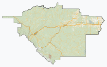
Marlboro is a small community called a hamlet in west-central Alberta, Canada. It is part of Yellowhead County. You can find Marlboro on the Yellowhead Highway (Highway 16). It is about 25 kilometers (15 miles) west of the town of Edson. A beautiful place called Sundance Provincial Park is also nearby, located northwest of the hamlet.
Statistics Canada officially recognizes Marlboro as a "designated place." This means it is a specific area used for counting people in the census.
How Many People Live Here?
|
|||||||||||||||||||||||||||||||||||||||||||||||||||||||||
Every few years, Canada counts all its people. This is called a census. In the 2021 Census, Marlboro had 97 people living there. They lived in 38 homes out of 43 total homes. This was a small decrease from 2016, when 114 people lived in Marlboro.
Marlboro covers a small area of land, about 0.29 square kilometers (0.11 square miles). In 2021, this meant there were about 333 people for every square kilometer.
In the 2016 Census, Marlboro had 114 people. They lived in 34 homes out of 40 total homes. This was an increase from 2011, when the population was 90. In 2016, Marlboro's land area was 0.38 square kilometers (0.15 square miles). This meant there were about 300 people per square kilometer.
 | Stephanie Wilson |
 | Charles Bolden |
 | Ronald McNair |
 | Frederick D. Gregory |


