Marmolejo facts for kids
Quick facts for kids Marmolejo |
|
|---|---|

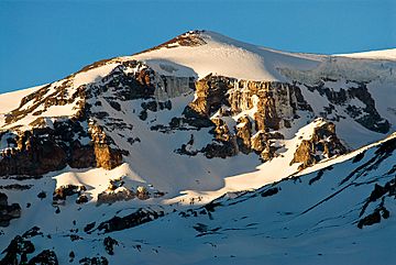
The Marmolejo summit cone sits on the edge of a 4 km (2 mi)-wide collapsed caldera.
|
|
| Highest point | |
| Elevation | 6,108 m (20,039 ft) |
| Prominence | 2,103 m (6,900 ft) |
| Parent peak | Tupungato |
| Geography | |
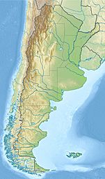
| Location | Argentina-Chile |
| Parent range | Principal Cordillera, Andes |
| Geology | |
| Mountain type | Stratovolcano |
| Last eruption | Unknown |
| Climbing | |
| First ascent | 01/10/1928 - Hermann Sattler, Sebastian Krückel and Albrecht Maass (Germany) |
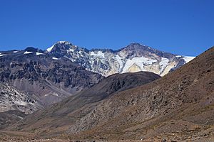
Volcán Marmolejo is a huge mountain that is also a stratovolcano. It stands 6,108 m (20,039 ft) tall in the Andes mountain range. This amazing peak is right on the border between Argentina and Chile.
Marmolejo is a type of volcano that looks like a tall, cone-shaped mountain. It was formed a very long time ago. It is located about 9 km (6 mi) northeast of another active volcano called San José. Marmolejo is special because it's the southernmost mountain in the world that is taller than 6,000 m (19,685 ft).
Part of the mountain in Argentina is a protected area. It's called the Provincial Reserve for Multiple Use and Natural Recreation Manzano / Portillo de Piuquenes. The mountain also sits on the border of two provinces: Mendoza in Argentina and Cordillera in Chile. Its slopes are near the cities of Tunuyán in Argentina and San José de Maipo in Chile.
First Climb
The first people to climb Marmolejo were Hermann Sattler, Sebastian Krückel, and Albrecht Maass. They were from Germany. They reached the top on October 1, 1928.
How Tall is Marmolejo?
The official height of Marmolejo is 6,108 m (20,039 ft). Scientists use different ways to measure mountains. For example, special maps made from satellites show its height as slightly different. Some measurements show it as 6,097 m (20,003 ft), while others show it as 6,103 m (20,023 ft) or even 6,129 m (20,108 ft).
Marmolejo is considered a very important mountain in its range. It stands out a lot from the land around it. The closest higher mountain is Tupungato.
See Also
 In Spanish: Cerro Marmolejo para niños
- List of volcanoes in Argentina
- List of volcanoes in Chile
Images for kids
 | John T. Biggers |
 | Thomas Blackshear |
 | Mark Bradford |
 | Beverly Buchanan |


