
Marsh Island (Maine) facts for kids

Penobscot River from Marsh Island
|
|

Marsh Island
Location in Maine
|
|
| Geography | |
|---|---|
| Coordinates | 44°55′N 68°39′W / 44.917°N 68.650°W |
| Length | 5.23 mi (8.42 km) |
| Width | 2.52 km (1.566 mi) |
| Highest elevation | 190 ft (58 m) |
| Administration | |
|
United States
|
|
| State | Maine |
| County | Penobscot |
Marsh Island is a cool island located in Penobscot County, in the state of Maine. It sits right in the middle of the Penobscot River. The main part of the Penobscot River flows along the eastern side of the island. On the western side, you'll find the Stillwater River, which is like a smaller branch of the Penobscot.
Contents
What's on Marsh Island?
Marsh Island is home to parts of two towns: Old Town and Orono. It's a busy place with lots going on!
University and Airport
The University of Maine has its main campus on the southwestern part of the island. This is where many students go to college. If you look at the northern end of the island, you'll find the Old Town Municipal Airport and Seaplane Base. This airport is special because it can handle both regular planes and seaplanes, which land on water!
Roads and Industry
A major road, U.S. Route 2, goes right across Marsh Island. This road helps connect Old Town and Orono, making it easy for people to travel between the two towns. There used to be a big paper mill in Old Town, on the island, which was a very important business for the area.
Wildlife on the Island
In 2011, Marsh Island became a place where people could hunt deer using bows. This helps manage the deer population on the island.
Images for kids
-
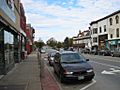
Main Street in Old Town on Marsh Island
-
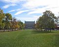
The University of Maine on Marsh Island
-
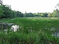
A peaceful wetland area on Marsh Island
-

Beautiful fall colors on Marsh Island


