Marum facts for kids
Quick facts for kids
Marum
|
|||
|---|---|---|---|
|
Town and former municipality
|
|||

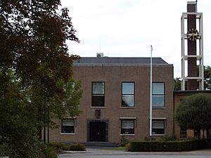
Marum town hall
|
|||
|
|||

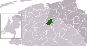
Location in Groningen
|
|||
| Country | |||
| Province | |||
| Municipality | |||
| Merged | 2019 | ||
| Area | |||
| • Total | 43.58 km2 (16.83 sq mi) | ||
| Elevation | 3 m (10 ft) | ||
| Population
(2021)
|
|||
| • Total | 8,125 | ||
| • Density | 186.44/km2 (482.87/sq mi) | ||
| Time zone | UTC+1 (CET) | ||
| • Summer (DST) | UTC+2 (CEST) | ||
| Postcode |
9363
|
||
| Area code | 0594 | ||
Marum is a town in the northeastern part of the Netherlands. It used to be its own municipality (like a small local government area) but joined a larger municipality called Westerkwartier on January 1, 2019.
Contents
History of Marum
Marum is located in an area that used to have a lot of peat (a type of soil made from decayed plants). Because of this, it started as a farming village. People first wrote about Marum in 1385. Its name probably means "village near the lake." In 1795, about 351 people lived there.
Marum began to grow and change in the early 1900s. A tram line from Groningen to Drachten helped the town develop. Later, when the A7 motorway was built, Marum became a place where people lived and commuted to bigger cities. In 2019, Marum stopped being a separate municipality and became part of Westerkwartier.
Villages in the Former Marum Municipality
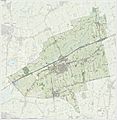
The area that used to be the municipality of Marum includes several villages. These are:
- Boerakker
- Jonkersvaart
- Lucaswolde
- Marum (the main town)
- Niebert
- Noordwijk
- Nuis
- De Wilp
Famous People from Marum
Some well-known people have come from Marum:
- Tjeerd van Dekken (born 1967) is a politician. A politician is someone who works in government, helping to make decisions for the public.
- Aafje Looijenga-Vos (1928–2018) was a crystallographer. A crystallographer is a scientist who studies crystals and how their atoms are arranged.
Gallery
See also
 In Spanish: Marum para niños
 | Toni Morrison |
 | Barack Obama |
 | Martin Luther King Jr. |
 | Ralph Bunche |


