Marwayne facts for kids
Quick facts for kids
Marwayne
|
|
|---|---|
|
Village
|
|
| Village of Marwayne | |
| Country | Canada |
| Province | Alberta |
| Region | Alberta |
| Census Division | No. 10 |
| Municipal district | County of Vermilion River |
| Incorporated | |
| • Village | December 31, 1952 |
| Area
(2021)
|
|
| • Land | 1.6 km2 (0.6 sq mi) |
| Elevation | 600 m (2,000 ft) |
| Population
(2021)
|
|
| • Total | 543 |
| • Density | 339.3/km2 (879/sq mi) |
| Time zone | UTC−7 (MST) |
| • Summer (DST) | UTC−6 (MDT) |
| Highways | 45 897 |
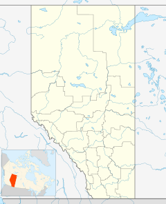
Marwayne is a small village located in central Alberta, Canada. It is about 44 kilometers (27 miles) northwest of the city of Lloydminster. The village is also just 21 kilometers (13 miles) west of the Saskatchewan border.
Marwayne is found where two important roads meet: Highway 45 and Highway 897. The main ways people earn a living here are through farming and raising animals (ranching). The oil and gas industry also plays a big part in the local economy.
The name of the village, Marwayne, is quite unique! It was created by combining parts of a family name and a place name. It honors the pioneer Marfleet family, who moved to Canada from Wainfleet, Lincolnshire, England. The first school in Marwayne opened its doors in 1928, helping to educate the children of the growing community.
Village Population
Let's look at how many people live in Marwayne.
Recent Census Data
According to the 2021 Census, the Village of Marwayne had a population of 543 people. These residents lived in 231 homes out of a total of 263 available homes.
This number shows a small change from the 2016 population, which was 564 people. The village covers a land area of 1.6 square kilometers (0.62 square miles). This means that in 2021, there were about 339 people living in each square kilometer.
Past Population Changes
In 2017, a local census counted 606 people living in Marwayne. Before that, in 2013, the population was 667.
The 2016 Census recorded 564 people living in the village. This was a slight decrease from the 2011 population of 612.
 | Emma Amos |
 | Edward Mitchell Bannister |
 | Larry D. Alexander |
 | Ernie Barnes |


