Masinasin, Alberta facts for kids
Quick facts for kids
Masinasin
|
|
|---|---|
|
Unincorporated community
|
|
| Country | Canada |
| Province | Alberta |
| Region | Southern Alberta |
| Planning region | South Saskatchewan |
| Municipal district | Warner |
| Founded | 1890s |
| Time zone | UTC−7 (MST) |
| • Summer (DST) | UTC−6 (MDT) |
| Postal code span |
TOK
|
| Area code(s) | +1-403 |
| Highways | Highway 500 Highway 501 |
Masinasin is a place in Alberta, Canada, that used to be a small community. Today, it's mostly empty, with just a few things left to show it was once there. It's located not too far from the Milk River and the Canada-United States border.
The name Masinasin comes from the Cree language. It means 'Writing on Stone'. This name refers to the ancient figures and writings carved into the sandstone cliffs along the Milk River.
What is Masinasin Today?
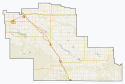
Masinasin is about 1 kilometer (0.6 miles) off Highway 501. It's also about 31 kilometers (19 miles) east of a town called Milk River. You can find it about 18 kilometers (11 miles) north of the border with the United States.
Today, all that remains of Masinasin is a small alternative school that teaches in a different way. There are also some baseball fields nearby. About 3 kilometers (1.9 miles) to the southeast, on Highway 500, you'll find the overgrown Pioneer Cemetery. This cemetery is a reminder of the people who once lived there.
Climate in Masinasin
Masinasin has a climate that is called "semi-arid continental." This means it's quite dry, and the weather changes a lot between summer and winter. It has hot summers and cold winters.
| Climate data for Masinasin, Alberta | |||||||||||||
|---|---|---|---|---|---|---|---|---|---|---|---|---|---|
| Month | Jan | Feb | Mar | Apr | May | Jun | Jul | Aug | Sep | Oct | Nov | Dec | Year |
| Record high °C (°F) | 17 (63) |
24 (75) |
23 (73) |
31.5 (88.7) |
33.5 (92.3) |
37 (99) |
39 (102) |
41 (106) |
37 (99) |
31 (88) |
24 (75) |
17.5 (63.5) |
41 (106) |
| Mean daily maximum °C (°F) | −0.5 (31.1) |
2.0 (35.6) |
6.7 (44.1) |
13.8 (56.8) |
19.4 (66.9) |
23.4 (74.1) |
28.3 (82.9) |
27.4 (81.3) |
20.8 (69.4) |
13.9 (57.0) |
4.9 (40.8) |
−0.8 (30.6) |
13.3 (55.9) |
| Daily mean °C (°F) | −6.2 (20.8) |
−4.1 (24.6) |
0.4 (32.7) |
6.6 (43.9) |
11.9 (53.4) |
16.0 (60.8) |
19.7 (67.5) |
18.9 (66.0) |
13.2 (55.8) |
7.1 (44.8) |
−0.9 (30.4) |
−6.6 (20.1) |
6.3 (43.3) |
| Mean daily minimum °C (°F) | −12 (10) |
−10.2 (13.6) |
−5.8 (21.6) |
−0.6 (30.9) |
4.3 (39.7) |
8.6 (47.5) |
11.0 (51.8) |
10.3 (50.5) |
5.6 (42.1) |
0.2 (32.4) |
−6.6 (20.1) |
−12.4 (9.7) |
−0.6 (30.9) |
| Record low °C (°F) | −39 (−38) |
−36.5 (−33.7) |
−35 (−31) |
−18.5 (−1.3) |
−6.5 (20.3) |
−1.5 (29.3) |
2 (36) |
−1.5 (29.3) |
−8 (18) |
−27 (−17) |
−34.5 (−30.1) |
−41 (−42) |
−41 (−42) |
| Average precipitation mm (inches) | 20.1 (0.79) |
16.8 (0.66) |
34.5 (1.36) |
33.6 (1.32) |
52.5 (2.07) |
78.3 (3.08) |
32.0 (1.26) |
37.6 (1.48) |
40.5 (1.59) |
23.3 (0.92) |
19.9 (0.78) |
17.5 (0.69) |
407.3 (16.04) |
| Source: 1981-2010 Environment Canada | |||||||||||||
History of Education
The Milk River Valley School District No. 2024 was started on August 24, 1909. The first school, called Milk River Valley school, was a one room schoolhouse. This means it had only one room for all the students and grades.
In 1941, the name of the school changed to Masinasin. This happened when several smaller school districts in the area joined together. Their schools were moved to the Masinasin location, making it a central place for education.
 | Shirley Ann Jackson |
 | Garett Morgan |
 | J. Ernest Wilkins Jr. |
 | Elijah McCoy |


