Masonboro, North Carolina facts for kids
Quick facts for kids
Masonboro, North Carolina
|
|
|---|---|
|
Former census-designated place
|
|
| City of Wilmington | |

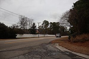
Masonboro Loop Road in Wilmington (originally located in Masonboro before annexation)
|
|

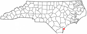
Location of Masonboro, North Carolina
|
|
| Country | United States |
| State | North Carolina |
| County | New Hanover |
| City | Wilmington |
| Area | |
| • Total | 6.6 sq mi (17.2 km2) |
| • Land | 6.0 sq mi (15.5 km2) |
| • Water | 0.6 sq mi (1.7 km2) |
| Elevation | 23 ft (7 m) |
| Time zone | UTC-5 (Eastern (EST)) |
| • Summer (DST) | UTC-4 (EDT) |
Masonboro was a place in New Hanover County, North Carolina. It was once called a "census-designated place" (CDP). This means it was an area identified by the government for counting people, but it wasn't an official city or town.
In the year 2000, about 11,812 people lived there. Masonboro was located southeast of Wilmington. It was also very close to the Atlantic coast.
Contents
Masonboro's Past: A Look at Its History
Early Beginnings and Naming Masonboro
The name "Masonboro" has an interesting past. A group called the Grand Lodge of Ancient Free and Accepted Masons of North Carolina recorded a Masonic Lodge in the area. This lodge was named "Solomon." It received its official permission from England way back in 1735.
A post office was open in Masonboro for a short time. It operated from 1890 to 1891. Many of the first people who settled in the area were Masons. This is why they chose the name Masonboro for the community.
Becoming Part of Wilmington
In the year 2000, Masonboro officially became part of Wilmington. This process is called "annexation." It means that Masonboro's land and people were fully added into the city limits of Wilmington. So, Masonboro is no longer a separate census-designated place.
Where Was Masonboro Located?
Masonboro was located at specific geographic coordinates: 34°10′12″N 77°52′16″W / 34.169953°N 77.871134°W.
The area covered by Masonboro was about 6.6 square miles (17.2 square kilometers). Most of this area was land, around 6.0 square miles (15.5 square kilometers). The rest was water, about 0.6 square miles (1.7 square kilometers). This means about 9.65% of Masonboro's total area was water.
Who Lived in Masonboro?
Population and Households in 2000
According to the census taken in 2000, there were 11,812 people living in Masonboro. These people lived in 4,253 different households. Out of these households, 3,474 were families.
The population density was about 1,970.5 people per square mile (760.8 people per square kilometer). There were also 4,452 housing units. A housing unit is a house, apartment, or other place where people live. The average density of housing units was 742.7 per square mile (286.8 per square kilometer).
Diversity of Residents
The people living in Masonboro came from different backgrounds.
- About 93.62% of the people were White.
- Around 3.35% were African American.
- About 0.28% were Native American.
- Roughly 1.32% were Asian.
- A small number, 0.02%, were Pacific Islander.
- About 0.32% were from other races.
- And 1.09% were from two or more races.
People who identified as Hispanic or Latino made up 1.17% of the population.
Family Life and Age Groups
Many households in Masonboro had children. About 42.3% of households had children under 18 living with them. Most households, 73.0%, were married couples living together. About 6.9% were female householders without a husband present. The remaining 18.3% were not families.
The average household had about 2.78 people. The average family had about 3.08 people.
The population was made up of different age groups:
- 28.8% were under 18 years old.
- 5.0% were between 18 and 24.
- 30.3% were between 25 and 44.
- 26.7% were between 45 and 64.
- 9.2% were 65 years old or older.
The median age in Masonboro was 38 years. This means half the people were younger than 38 and half were older. For every 100 females, there were about 96.0 males.
See also
 In Spanish: Masonboro para niños
 | Selma Burke |
 | Pauline Powell Burns |
 | Frederick J. Brown |
 | Robert Blackburn |

