Mather Peaks facts for kids
Quick facts for kids Mather Peaks |
|
|---|---|
| Highest point | |
| Elevation | 12,400 ft (3,800 m) |
| Prominence | 1,480 ft (450 m) |
| Geography | |
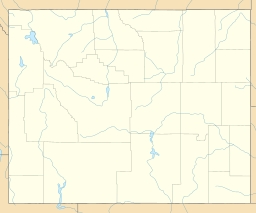
| Location | Big Horn and Johnson Counties, Wyoming, U.S. |
| Parent range | Bighorn Mountains |
| Topo map | USGS Lake Helen |
| Climbing | |
| Easiest route | Scramble |
Mather Peaks is a tall mountain located in the Bighorn Mountains of Wyoming, a state in the United States. This impressive peak reaches an elevation between 12,404 and 12,444 feet (about 3,781 to 3,793 meters) above sea level. It is known as the sixth highest peak in the entire Bighorn Mountain range.
Where is Mather Peaks Located?
Mather Peaks stands proudly within the Cloud Peak Wilderness, which is part of the larger Bighorn National Forest. This area is protected to keep its natural beauty safe. The mountain is found in both Big Horn and Johnson Counties in Wyoming.
Nearby Landmarks
Mather Peaks is situated near other notable mountains in the region. It is about 4.5 miles (7.2 kilometers) northwest of Darton Peak. It also lies about 3.2 miles (5.1 kilometers) south of Bomber Mountain. These distances help people understand its position within the mountain range.
What Kind of Mountain is Mather Peaks?
Mather Peaks is a rugged mountain that offers a challenging climb. The easiest way to reach its top is by "scrambling." Scrambling means climbing over rocks and steep terrain using both your hands and feet, but it's not as difficult as technical rock climbing that requires ropes and special gear. It's a popular activity for experienced hikers and climbers.


