Matureivavao facts for kids

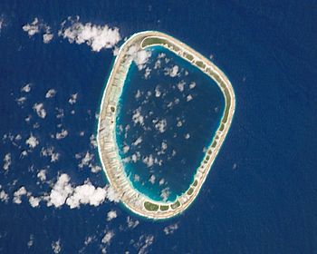
NASA picture of Matureivavao Atoll
|
|
| Geography | |
|---|---|
| Location | Pacific Ocean |
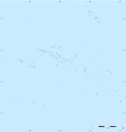
| Coordinates | 21°29′S 136°25′W / 21.483°S 136.417°W |
| Archipelago | Tuamotus |
| Area | 18 km2 (6.9 sq mi) (lagoon) 2.5 km2 (1 sq mi) (above water) |
| Length | 6.6 km (4.1 mi) |
| Width | 4.6 km (2.86 mi) |
| Administration | |
|
France
|
|
| Overseas collectivity | French Polynesia |
| Administrative subdivision | Tuamotus |
| Commune | Gambier Islands |
| Demographics | |
| Population | Uninhabited (2012) |
Matureivavao, also called Maturei-vavao, is an atoll in the Pacific Ocean. An atoll is a ring-shaped island made of coral, with a lagoon in the middle. This atoll is part of the Acteon Group in the southeastern Tuamotu Islands. It is the biggest atoll in the Acteon Group. Matureivavao is not home to any people. It is managed by the Gambier Islands in French Polynesia.
Contents
Exploring Matureivavao's Geography
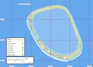
Matureivavao is shaped like a long oval. It stretches about 6.6 km (4.1 mi) from north-northwest to south-southeast. It is about 4.6 km (2.9 mi) wide. The land area of the atoll is about 2.5 km2 (1.0 sq mi). Its central lagoon covers about 18 km2 (6.9 sq mi).
This atoll is located about 16 km (10 mi) southeast of another island called Tenarunga. It is also about 1,390 km (860 mi) away from Tahiti. Matureivavao is tall enough that you can see it from far away. It looks like a sandy beach with a line of dark green trees behind it. Sometimes, during bad weather, ocean waves can wash over the coral reef. There is no easy way for boats to enter the lagoon. Some maps also show this atoll as "Melbourne".
A Look at Matureivavao's History
The first time this atoll was officially seen was on February 5, 1606. This happened during a Spanish trip led by a Portuguese explorer named Pedro Fernández de Quirós. He called the islands Las Cuatro Coronadas, meaning "the four crowned" (because of their coconut trees). However, his notes were not very clear.
The first time the island was definitely seen was on March 14, 1828. This was by explorer Hugh Cuming on his ship Discoverer. Later, in 1833, navigator Thomas Ebrill saw it on his ship Amphitrite. Then, in 1837, Lord Edward Russell saw it. He was the commander of the ship HMS Actaeon, which is how the island group got its name. Matureivavao used to be owned by a person named Captain Nicholas. But it was bought back in 1934.
Plants and Animals of Matureivavao
In 1983, a big hurricane hit Matureivavao. After the storm, thousands of new coconut trees were planted all over the atoll. The island is home to different types of plants, including some from the Amaranthaceae family. One specific plant found here is Achyranthes aspera var. velutina. Matureivavao is special because it is one of the few atolls where rats have never been introduced. This helps protect the native wildlife.
See also
 In Spanish: Matureivavao para niños
- Tenararo
- Tenarunga
- Vahanga
- Acteon Group
- Desert island
- List of islands
 | Jackie Robinson |
 | Jack Johnson |
 | Althea Gibson |
 | Arthur Ashe |
 | Muhammad Ali |


