Maungaraki facts for kids
Quick facts for kids Maungaraki |
|
|---|---|
 |
|
| Basic information | |
| Electoral ward | Western |
| Date established | 1960s |
| Land area | 212 ha (0.82 sq mi)* |
| Population | 4,250 (June 2023) |
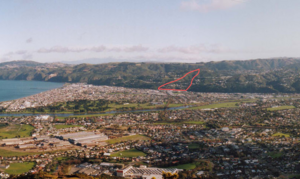
Maungaraki is a neighbourhood in Lower Hutt, New Zealand. It is one of many suburbs built on the western hills of the Hutt Valley. It is the largest housing area on these hills, which are close to the Wellington Fault (a big crack in the Earth's crust).
The name Maungaraki comes from the Māori words for "northern mountain." This might refer to a Māori village (called a pā) that used to be south of Maungaraki, in a place called Petone.
In 2021, a national news website called Stuff said Maungaraki was the best suburb to live in the Wellington area. They liked it because it gets a lot of sunshine, has great schools, amazing views, a mix of different people, and low crime.
Contents
What Makes Maungaraki Special?
This suburb has its own shopping centre where you can find stores. It also has a Baptist church and a community hall. The community hall is looked after by the Maungaraki Community Association. The church building used to be a dining hall in another area called Moera. It was moved to Maungaraki and fixed up to become a church in 2002.
There is one school in Maungaraki called Maungaraki School. It is a primary school for students from Year 1 to Year 8. This school was created in 1999 when two older schools, Puketiro and Otonga, joined together. Maungaraki also has a kindergarten and a playcentre for younger children.
A lot of Maungaraki is part of the Belmont Regional Park. You can find many walking paths from the suburb that lead into the park. The Korokoro Dam and its waterfall are both inside the park and within the Maungaraki area.
Maungaraki's Past
More and more houses were built in Maungaraki very quickly during the 1960s. At that time, it was the biggest housing project ever done by a local government in New Zealand.
The main road that goes through the suburb is called Dowse Drive. This road is named after Percy Dowse, who was the Mayor of Lower Hutt from 1950 to 1970. He was important in planning the housing development in Maungaraki. Most of the other roads in the suburb are named after different types of trees. Reese Jones Grove is named after Thomas and Myrtle Reese Jones. They were a farming couple from Korokoro who sold some of their land in Maungaraki to the Lower Hutt City Council in 1957.
Puketiro School first opened in 1967. It was located where Maungaraki School is now. Otonga School opened later in 1977. Most of the land where Otonga School used to be is now private homes.
Who Lives in Maungaraki?
The Maungaraki area covers about 2.12 square kilometres. As of June 2023, it has an estimated population of 4,250 people. This means there are about 2005 people living in each square kilometre.
In 2018, Maungaraki had 3,987 people living there. This was an increase of 210 people since 2013. The average age of people in Maungaraki was 37.4 years old. About 21.5% of the people were under 15 years old.
Most people in Maungaraki are of European background (74.2%). There are also people of Māori (10.2%), Asian (20.6%), and Pasifika (4.3%) backgrounds. About 29.6% of the people living in Maungaraki were born outside New Zealand.
When asked about religion, 50.5% of people said they had no religion. About 34.1% were Christian.
Many people in Maungaraki have a good education. About 35.5% of adults had a university degree or higher. The average income was $46,200. Most adults (59.6%) worked full-time.
Education in Maungaraki
Maungaraki School is a public primary school for both boys and girls. It teaches students from Year 1 to Year 8. The school currently has 364 students as of February 2024.
 | John T. Biggers |
 | Thomas Blackshear |
 | Mark Bradford |
 | Beverly Buchanan |


