Maverick Junction, South Dakota facts for kids
Quick facts for kids
Maverick Junction, South Dakota
|
|
|---|---|
| Country | United States |
| State | South Dakota |
| County | Fall River |
| Elevation | 3,265 ft (995 m) |
| Population
(2020)
|
|
| • Total | 46 |
| Time zone | UTC-7 (MST) |
| • Summer (DST) | UTC-6 (MDT) |
| Area code(s) | 605 |
| GNIS feature ID | 2807104 |
| Maverick Junction | |
|---|---|
| Location | |
| Roads at junction: |
|
| Construction | |
| Maintained by: | South Dakota Department of Transportation |
| Map | |
| Lua error in Module:Infobox_road/map at line 15: attempt to index field 'wikibase' (a nil value). | |
Maverick Junction (Lakota: Mniwóblu Oínažiŋ) is a small community in South Dakota, United States. It's an unincorporated community, meaning it's not officially a town or city. It's also a census-designated place (CDP), which means the U.S. Census Bureau counts its population.
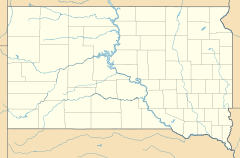
Maverick Junction is located in Fall River County. It sits right where three important roads meet: South Dakota Highway 79, US Highway 18, and US Highway 385. This spot is about five miles southeast of Hot Springs. In 2020, only 46 people lived there.
Contents
History of Maverick Junction
Maverick Junction has been known by this name for many years. It's a key meeting point for roads in the Black Hills area. The exact reason for its name isn't fully known. It might have been the name of an early truck stop or business located here.
This area has been a road junction since at least 1926. Back then, South Dakota Highway 79 met with South Dakota Highway 50 (which is now US-18). The current road setup was created in the early 1960s. This change helped roads avoid an older bridge over the Fall River. It also bypassed a historic bridge over the Cheyenne River.
Businesses at the Junction
Over the years, many different businesses have opened at Maverick Junction. You can find stores, restaurants, and gas stations there. Other businesses include places for sand and gravel, storage units, and concrete mixing.
The South Dakota Department of Transportation also has a maintenance shop here. This shop helps keep the roads in good condition. Recently, a big road project called the Heartland Expressway has brought new businesses. These include a campground and construction companies.
The Heartland Expressway
The Heartland Expressway is a major road system. It connects the eastern side of the Black Hills to cities in Nebraska and Colorado. South Dakota Highway 79 and US-18/385, south of Maverick Junction, are part of this important route.
By 2009, the expressway was a four-lane highway from Rapid City to Maverick Junction. The next part of the road, heading south to Nebraska, was also being built. This project received millions of dollars in funding.
Maverick Junction's Importance
Maverick Junction is a key entry point to the Black Hills. Travelers from eastern South Dakota use US-18 to get there. People from Nebraska often use US-385. It's also one of the main ways to reach the Black Hills from Colorado.
Some parts of US-18 and US-385 have had different names over time. These include the Grant Highway, the Black Hills Sioux Trail, and the Oyate Trail. South Dakota Highway 79 is a fast route around the southern Black Hills. It has smoother terrain, so cars can travel at 70 miles per hour. This is 5 mph faster than most rural speed limits in South Dakota.
Leslie Jensen Memorial Highway
The road from Maverick Junction to Hot Springs is about 4.5 miles long. This part of US-18/385 is called the Leslie Jensen Memorial Highway. It's named after Leslie Jensen, who was South Dakota's 15th governor.
This highway follows the Fall River through a canyon. Hot Springs is a popular town known for its old buildings from the 1890s. It also has many tourist attractions and services for veterans. Hot Springs is also the way to get to Wind Cave National Park.
 | Mary Eliza Mahoney |
 | Susie King Taylor |
 | Ida Gray |
 | Eliza Ann Grier |


