Maxima Caesariensis facts for kids
Maxima Caesariensis was a Roman province in Britain. Its name means "The Caesarian province of Maximus" in Latin. It was also sometimes called Britannia Maxima. This province was one of several new areas created in Britain during the Diocletian Reforms around the end of the 3rd century.
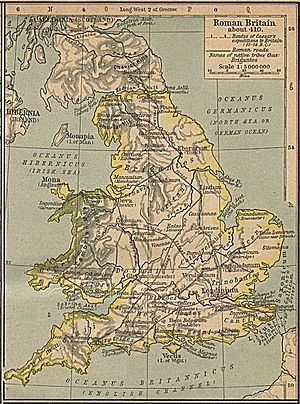
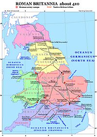
It was likely formed after the Roman general Constantius Chlorus defeated a rebel leader named Allectus in AD 296. Maxima Caesariensis is mentioned in a list of Roman provinces from about AD 312, called the Verona List. We don't know exactly where this province was or what its main city was. However, it was probably next to another province called Flavia Caesariensis. Because its governor eventually held a high rank (called "consular"), many historians believe it included Londinium (modern-day London) and the southeast part of England.
History of Roman Britain's Provinces
After the Roman conquest of Britain, Britain was first managed as a single large province. Its capital was first Camulodunum (Colchester) and then Londinium (London). Later, after a revolt by a governor named Clodius Albinus, the territory was split into two parts: Upper Britain (Britannia Superior) and Lower Britain (Britannia Inferior). The capital of Upper Britain was Londinium, and Lower Britain's capital was Eboracum (York).
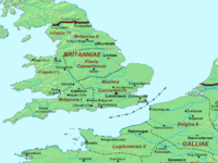
Around the time of the Diocletian Reforms, Britain was controlled by a rebel empire led by Allectus. In AD 296, Constantius Chlorus took back control of Britain for the Roman Empire. After this, the "Diocese of the Britains" was created. A "diocese" was a larger administrative area, and it was part of the "Prefecture of Gaul." The Britains were then divided into several smaller provinces. These provinces were likely Prima, Secunda, Maxima Caesariensis, and possibly Flavia Caesariensis and Valentia.
Where Was Maxima Caesariensis?
Historians are not completely sure about the exact locations and capitals of these later Roman provinces in Britain. However, an important Roman document called the Notitia Dignitatum tells us that the governor of Maxima Caesariensis was given a very high rank, called "consular." This was a step up from their original rank, which was "equestrian praeses" (a type of Roman official).
Many experts connect this high-ranking governor with the administration in Londinium (London). Londinium was also the main city for the overall "Diocese of the Britains."
In the past, some people, like Gerald of Wales, thought that "Maximia" was located around Eboracum (York). He also believed that Londinium was in the province of Flavia. Gerald thought Maxima was named after an emperor called Maximus. Later, William Camden agreed with this idea. A famous but fake document from the 1740s, called The Description of Britain, also supported this view. It even gave Maxima borders from the Humber and Mersey rivers all the way to Hadrian's Wall. However, this fake document was proven wrong in the mid-1800s.
Today, scholars are still debating whether the province was named after the western senior emperor Valerius Maximian or the eastern junior emperor Galerius Maximian. One historian, Eric Birley, suggested that Maxima and Flavia were originally one province. He thought it was called Britannia Caesariensis as a special honor for helping against the rebel Allectus in 296.
While Flavia is usually thought to have been created from the old province of Lower Britain, Birley proposed a different idea. He suggested that Upper Britain was first divided into two parts (Prima and Caesariensis). Then, it was divided again into three parts: Prima, Maxima, and Flavia. This idea is similar to an older theory by William Camden, who believed Maxima was formed first, and Flavia came later.
 | Kyle Baker |
 | Joseph Yoakum |
 | Laura Wheeler Waring |
 | Henry Ossawa Tanner |


