Maxville, Wisconsin facts for kids
Quick facts for kids
Maxville, Wisconsin
|
|
|---|---|

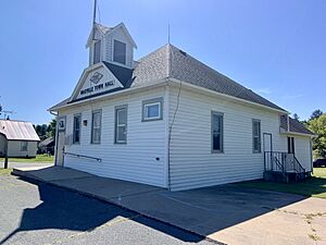
Town hall
|
|

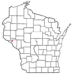
Location of Maxville, Wisconsin
|
|
| Country | |
| State | |
| County | Buffalo |
| Area | |
| • Total | 42.7 sq mi (110.7 km2) |
| • Land | 41.0 sq mi (106.3 km2) |
| • Water | 1.7 sq mi (4.4 km2) |
| Elevation | 856 ft (261 m) |
| Population
(2010)
|
|
| • Total | 309 |
| • Density | 8/sq mi (2.9/km2) |
| Time zone | UTC-6 (Central (CST)) |
| • Summer (DST) | UTC-5 (CDT) |
| FIPS code | 55-50075 |
| GNIS feature ID | 1583674 |
Maxville is a small town located in Buffalo County, which is part of the U.S. state of Wisconsin. In 2010, about 309 people lived here. The town is also home to the small community of Maxville and the historic site of Savoy, which is now a ghost town.
Contents
Maxville's Location and Landscape
Maxville is in the northwest corner of Buffalo County. It shares its northern and western borders with Pepin County. The western edge of the town is marked by the Chippewa River. This river is an important waterway that flows into the larger Mississippi River.
According to the United States Census Bureau, the town covers a total area of about 110.7 square kilometers (42.7 square miles). Most of this area, about 106.3 square kilometers (41.0 square miles), is land. The remaining 4.4 square kilometers (1.7 square miles) is water, making up about 4% of the town's total area.
Who Lives in Maxville?
In 2000, a census showed that 325 people lived in Maxville. These people lived in 115 households, and 89 of these were families. The town had about 7.7 people living in each square mile.
Families and Households
Many households in Maxville had children under 18 living with them. About 64% of households were married couples living together. Some households, about 20%, were made up of single individuals. A small number of people, about 7.8%, lived alone and were 65 years old or older. On average, each household had about 2.83 people.
Age Groups in Maxville
The population in Maxville was spread across different age groups. About 30% of the people were under 18 years old. Around 9.5% were young adults aged 18 to 24. The largest group, about 28.6%, was between 25 and 44 years old. People aged 45 to 64 made up 23.1% of the population. Finally, about 8.6% of the residents were 65 years old or older. The average age in the town was 33 years.
Getting Around Maxville
Roads
Wisconsin State Highway 25 is a main road that runs through Maxville. It goes in a north-south direction, helping people travel through the town.
Railroad History
An old railroad line, called the Tiffany Bottoms historical railroad, runs through Maxville. This track used to belong to the Milwaukee Road. It stopped being used in 1977 after a train accident.
In 1995, a group called the Chippewa Valley Motor Car Association started leasing the track. They got the rights from Xcel Energy. Since 2021, they have leased the tracks from the Wisconsin DNR. This group now offers special trips on the railroad. These trips go into the Tiffany Wildlife Area, which is south of Durand, and also along the Chippewa River.
See also
 In Spanish: Maxville (Wisconsin) para niños


