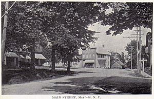
Mayfield (village), New York facts for kids
Quick facts for kids
Mayfield, New York
|
|
|---|---|
| Country | United States |
| State | New York |
| County | Fulton |
| Town | Mayfield |
| Area | |
| • Total | 1.19 sq mi (3.07 km2) |
| • Land | 1.01 sq mi (2.61 km2) |
| • Water | 0.18 sq mi (0.47 km2) |
| Elevation | 850 ft (259 m) |
| Population
(2020)
|
|
| • Total | 780 |
| • Density | 775.35/sq mi (299.29/km2) |
| Time zone | UTC-5 (Eastern (EST)) |
| • Summer (DST) | UTC-4 (EDT) |
| ZIP code |
12117
|
| Area code(s) | 518 |
| FIPS code | 36-46206 |
| GNIS feature ID | 0956705 |
Mayfield is a small village located in Fulton County, New York, in the United States. It is found in the center of the larger town of Mayfield. The village is northeast of Gloversville. In 2020, about 780 people lived here.
Contents
Village Location and Surroundings
Mayfield village covers a total area of about 3.07 square kilometers (1.19 square miles). Most of this area is land, but a small part is water.
The village is at the southwest end of Great Sacandaga Lake. It is also on the southern edge of the Adirondack Park, a large protected natural area. Mayfield is on the north side of Mayfield Lake, where Mayfield Creek flows into the lake.
Roads and Travel
New York State Route 30 runs along the western side of the village. This road goes northeast for about 16 kilometers (10 miles) to Northville. It also goes south for about 23 kilometers (14 miles) to Amsterdam.
Another road, Route 30A, starts just west of Mayfield. It leads southwest about 10 kilometers (6 miles) to Gloversville. It continues on to Johnstown, which is the main city of Fulton County, about 16 kilometers (10 miles) away.
Mayfield's Past
The village of Mayfield was officially formed in the year 1896.
People Living in Mayfield
| Historical population | |||
|---|---|---|---|
| Census | Pop. | %± | |
| 1880 | 219 | — | |
| 1900 | 589 | — | |
| 1910 | 590 | 0.2% | |
| 1920 | 592 | 0.3% | |
| 1930 | 722 | 22.0% | |
| 1940 | 759 | 5.1% | |
| 1950 | 761 | 0.3% | |
| 1960 | 818 | 7.5% | |
| 1970 | 981 | 19.9% | |
| 1980 | 944 | −3.8% | |
| 1990 | 817 | −13.5% | |
| 2000 | 800 | −2.1% | |
| 2010 | 832 | 4.0% | |
| 2020 | 780 | −6.2% | |
| U.S. Decennial Census | |||
In 2000, there were 800 people living in Mayfield. These people made up 307 households. About 221 of these were families. The village had about 349 homes.
Most people in the village were White (98.38%). A small number were Black (0.50%) or Native American (0.75%). Some people were of two or more races (0.38%). About 0.75% of the population was Hispanic or Latino.
Households and Families
Out of the 309 households, 37.5% had children under 18 living there. About 51.1% were married couples living together. Some households (16.5%) had a female head with no husband. About 28.2% were not families.
Around 22.0% of all households had only one person living in them. About 10.0% had someone living alone who was 65 or older. On average, there were 2.59 people per household. The average family had 3.00 people.
Age Groups
The population of Mayfield was spread out by age. About 29.5% of people were under 18 years old. Around 8.0% were between 18 and 24. About 29.6% were between 25 and 44. People aged 45 to 64 made up 17.8%. Finally, 15.1% were 65 years or older. The average age in the village was 36 years.
Income Information
In 2000, the average income for a household in Mayfield was $35,781. For families, the average income was $39,792. Men earned about $30,139 on average. Women earned about $21,620. The average income per person in the village was $15,604.
About 8.7% of families and 10.8% of all people lived below the poverty line. This included 14.1% of those under 18. It also included 6.3% of those aged 65 or over.
See also
 In Spanish: Mayfield (villa) para niños
 | Victor J. Glover |
 | Yvonne Cagle |
 | Jeanette Epps |
 | Bernard A. Harris Jr. |


