McBride, Missouri facts for kids
Quick facts for kids
McBride, Missouri
|
|
|---|---|

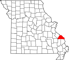
Location of Perry County, Missouri
|
|
| Country | United States |
| State | Missouri |
| County | Perry |
| Township | Bois Brule |
| Elevation | 371 ft (113 m) |
| Time zone | UTC-6 (Central (CST)) |
| • Summer (DST) | UTC-5 (CDT) |
| ZIP code |
63775
|
| Area code(s) | 573 |
| FIPS code | 29-44786 |
| GNIS feature ID | 722028 |
McBride is a small, unincorporated community in Perry County, Missouri, United States. This means it's a place where people live, but it doesn't have its own official local government like a city or town. McBride is located in Bois Brule Township, about eight miles northeast of Perryville.
Contents
How McBride Got Its Name
The community of McBride was named after the McBride family. They were important landowners who lived in this area a long time ago.
A Look at McBride's History
The very first settlers in the McBride area were the McBride family. Stephan McBride led his family here in 1837. They came from Kentucky, specifically from Nelson and Marion counties.
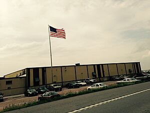
The community grew up around the Frisco Rail line, which was a railroad. McBride even had its own train station! Today, McBride is home to the Gilster-Mary Lee Popcorn and Cereal plant, which is a big part of the community.
Flooding in McBride
McBride has faced several floods over the years. The Great Flood of 1993 was especially damaging and caused a lot of destruction in the community.
Where is McBride Located?
McBride is located in a flat area called the Bois Brule Bottom, right along Bois Brule Creek. The soil in this area is very rich in nutrients, which made the land perfect for farming.
 | Bayard Rustin |
 | Jeannette Carter |
 | Jeremiah A. Brown |


