McCauley Mountain (Ohio, New York) facts for kids
Quick facts for kids McCauley Mountain |
|
|---|---|
| Highest point | |
| Elevation | 1,831 feet (558 m) |
| Geography | |
| Location | NE of Ohio, New York, U.S. |
| Topo map | USGS Black Creek Lake |
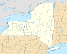
McCauley Mountain is a natural high point, also known as a summit, located in the beautiful Central New York Region of New York State. It stands tall in Herkimer County, near the town of Ohio. This mountain is a notable part of the landscape in this area.
Contents
Exploring McCauley Mountain
McCauley Mountain is a specific type of landform called a summit. A summit is simply the highest point of a mountain or hill. McCauley Mountain rises above the surrounding land, making it a recognizable feature in the region.
Where is McCauley Mountain Located?
This mountain is found in the northeastern part of the town of Ohio. This area is part of Herkimer County, which is in the larger Central New York Region. Its location makes it a part of the diverse geography of New York State.
How Tall is McCauley Mountain?
McCauley Mountain reaches an elevation of 1,831 feet (about 558 meters) above sea level. This measurement tells us how high the mountain's summit is compared to the ocean. It's a significant height for a mountain in this part of New York.
Mapping McCauley Mountain
Geographers and hikers often use special maps to find and explore mountains. The USGS (United States Geological Survey) has mapped McCauley Mountain on its Black Creek Lake topographic map. These maps show details like elevation, trails, and natural features.
 | Aurelia Browder |
 | Nannie Helen Burroughs |
 | Michelle Alexander |


