McClave, Colorado facts for kids
Quick facts for kids
McClave, Colorado
|
|
|---|---|

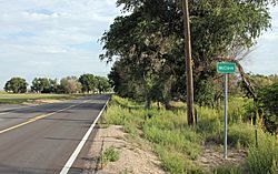
Entering McClave from the south.
|
|
| Country | |
| State | |
| County | Bent County |
| Government | |
| • Type | unincorporated town |
| Area | |
| • Total | 1.914 sq mi (4.956 km2) |
| • Land | 1.914 sq mi (4.956 km2) |
| Elevation | 3,865 ft (1,178 m) |
| Population
(2020)
|
|
| • Total | 725 |
| • Density | 378.88/sq mi (146.29/km2) |
| Time zone | UTC-7 (MST) |
| • Summer (DST) | UTC-6 (MDT) |
| ZIP Code |
81057
|
| Area code(s) | 719 |
| GNIS feature | McClave CDP |
McClave is a small community in Bent County, Colorado, in the United States. It is called an "unincorporated community" because it doesn't have its own local government like a city or town. In 2020, about 725 people lived in McClave.
Contents
A Look Back at McClave's History
The community of McClave got its start a long time ago. Its post office first opened in 1908. The area was named after B. I. McClave, who was an early settler there. The post office in McClave uses the ZIP code 81057.
McClave offers several important services for its residents. These include a local store where people can buy things, a gas station for cars, and, of course, the post office. There is also a school for students from kindergarten all the way through 12th grade. This school has a big athletic field for sports and outdoor activities.
Understanding McClave's Geography
McClave is located in southeastern Colorado. The area known as the McClave Census Designated Place (CDP) covers about 4.956 square kilometers (or about 1.9 square miles). All of this area is land, with no large bodies of water inside its boundaries.
McClave's Climate and Weather
The weather in McClave is described as semi-arid. This means it's quite dry, but not as dry as a desert. It gets some rain, but not a lot.
| Climate data for McClave, Colorado | |||||||||||||
|---|---|---|---|---|---|---|---|---|---|---|---|---|---|
| Month | Jan | Feb | Mar | Apr | May | Jun | Jul | Aug | Sep | Oct | Nov | Dec | Year |
| Mean daily maximum °C (°F) | 45 (7) |
51 (11) |
59 (15) |
70 (21) |
78 (26) |
89 (32) |
94 (34) |
92 (33) |
84 (29) |
72 (22) |
57 (14) |
46 (8) |
70 (21) |
| Mean daily minimum °C (°F) | 14 (−10) |
19 (−7) |
26 (−3) |
37 (3) |
47 (8) |
57 (14) |
63 (17) |
61 (16) |
51 (11) |
37 (3) |
24 (−4) |
16 (−9) |
38 (3) |
| Average precipitation mm (inches) | 0.4 (10) |
0.4 (10) |
0.8 (20) |
1.4 (36) |
2.3 (58) |
2.2 (56) |
2.4 (61) |
2.1 (53) |
1.2 (30) |
0.9 (23) |
0.5 (13) |
0.5 (13) |
15.3 (390) |
| Source: Weatherbase | |||||||||||||
Who Lives in McClave?
The United States Census Bureau keeps track of how many people live in different places across the country. They count the population of the McClave Census Designated Place (CDP) during their official counts.
| McClave CDP, Colorado | ||
|---|---|---|
| Year | Pop. | ±% |
| 2020 | 725 | — |
| Source: United States Census Bureau | ||
 | James Van Der Zee |
 | Alma Thomas |
 | Ellis Wilson |
 | Margaret Taylor-Burroughs |


