McGuffey, Ohio facts for kids
Quick facts for kids
McGuffey, Ohio
|
|
|---|---|
|
Village
|
|

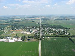
Aerial view of McGuffey from the south
|
|

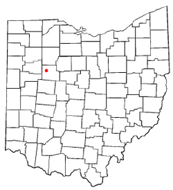
Location of McGuffey, Ohio
|
|

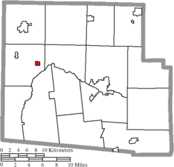
Location of McGuffey in Hardin County
|
|
| Country | United States |
| State | Ohio |
| County | Hardin |
| Township | Marion |
| Area | |
| • Total | 0.37 sq mi (0.96 km2) |
| • Land | 0.37 sq mi (0.96 km2) |
| • Water | 0.00 sq mi (0.00 km2) |
| Elevation | 971 ft (296 m) |
| Population
(2020)
|
|
| • Total | 466 |
| • Density | 1,252.69/sq mi (483.06/km2) |
| Time zone | UTC-5 (Eastern (EST)) |
| • Summer (DST) | UTC-4 (EDT) |
| ZIP code |
45859
|
| Area code(s) | 419|567 |
| FIPS code | 39-46046 |
| GNIS feature ID | 2399295 |
McGuffey is a small village located in Hardin County, Ohio, United States. In 2020, a count of the people living there, called a census, showed that 466 people lived in McGuffey.
History
McGuffey was first planned out in 1890. It was named after a person named John McGuffey. He gave land for a train station, and in return, the village was named after him. A post office opened in McGuffey in 1883. The village officially became a village in 1896.
Geography
McGuffey is located in Ohio. The United States Census Bureau says that the village covers a total area of about 0.36 square miles (0.96 square kilometers). All of this area is land, meaning there are no large bodies of water within the village limits.
People of McGuffey
| Historical population | |||
|---|---|---|---|
| Census | Pop. | %± | |
| 1900 | 452 | — | |
| 1910 | 491 | 8.6% | |
| 1920 | 688 | 40.1% | |
| 1930 | 710 | 3.2% | |
| 1940 | 618 | −13.0% | |
| 1950 | 639 | 3.4% | |
| 1960 | 647 | 1.3% | |
| 1970 | 704 | 8.8% | |
| 1980 | 646 | −8.2% | |
| 1990 | 550 | −14.9% | |
| 2000 | 522 | −5.1% | |
| 2010 | 501 | −4.0% | |
| 2020 | 466 | −7.0% | |
| U.S. Decennial Census | |||
2010 Census Information
In 2010, a census counted 501 people living in McGuffey. These people lived in 192 different homes, called households. Out of these, 131 were families. The village had a population density of about 1,392 people per square mile (or 537 people per square kilometer). This means how many people live in a certain amount of space. There were also 229 housing units, which are places where people can live.
Most of the people in the village were White (96.6%). A smaller number were African American (0.6%), Native American (0.4%), or Asian (0.4%). About 2.0% of the people were from two or more races. A very small number (0.2%) were Hispanic or Latino.
Many homes had children under 18 living there (40.6%). About 41.1% of the homes were married couples living together. Some homes had a female head of the house without a husband (19.3%), and a few had a male head of the house without a wife (7.8%). About 28.1% of all homes were made up of individuals living alone. In 16.1% of homes, someone aged 65 or older lived alone. The average number of people in a household was 2.61, and the average family had 3.07 people.
The average age of people in McGuffey was 35.6 years old. About 26.7% of residents were under 18. People aged 18 to 24 made up 9.9% of the population. Those aged 25 to 44 were 25.6%. People aged 45 to 64 were 24%. Finally, 14% of the population was 65 years old or older. When looking at gender, 46.1% of the people were male, and 53.9% were female.
See also
 In Spanish: McGuffey (Ohio) para niños
 | Roy Wilkins |
 | John Lewis |
 | Linda Carol Brown |


