
McKittrick, California facts for kids
Quick facts for kids
McKittrick, California
|
|
|---|---|

Location in Kern County and the state of California
|
|

McKittrick, California
Location in the United States
|
|
| Country | United States |
| State | California |
| County | Kern |
| Area | |
| • Total | 2.617 sq mi (6.778 km2) |
| • Land | 2.617 sq mi (6.778 km2) |
| • Water | 0 sq mi (0 km2) 0% |
| Elevation | 1,056 ft (322 m) |
| Population
(2010)
|
|
| • Total | 115 |
| • Density | 43.94/sq mi (16.97/km2) |
| Time zone | UTC-8 (PST) |
| • Summer (DST) | UTC−7 (PDT) |
| ZIP Code |
93251
|
| Area code(s) | 661 |
| FIPS code | 06-44924 |
| GNIS feature ID | 0245709 |
McKittrick is a small community in Kern County, California, United States. It's about 14 miles (22.5 km) northwest of Taft. The community sits 1,056 feet (322 meters) above sea level. In 2010, 115 people lived there. The United States Census Bureau calls McKittrick a "census-designated place" (CDP). This means it's a special area used for gathering statistics.
Contents
About McKittrick's Location
McKittrick is found where two main roads meet: State Route 33 and State Route 58.
The community covers an area of about 2.6 square miles (6.7 square kilometers). All of this area is land.
Oil Fields Near McKittrick
McKittrick is in the middle of a big oil-producing area. This region is in the western part of Kern County.
- To the south is the Midway-Sunset Oil Field. This is the second-largest oil field in the United States.
- The McKittrick Oil Field is right in town and to its west.
- The huge Cymric Field is to the northwest.
- Further north along Highway 33 is the large South Belridge Oil Field.
- East of McKittrick is the Elk Hills Field. This used to be a special oil reserve for the U.S. Navy.
McKittrick Tar Pits
McKittrick is also home to the McKittrick Tar Pits. These are natural pools of tar that ooze from the ground. They are similar to the famous La Brea Tar Pits in Los Angeles.
The tar pits contain many bones of animals from the Ice Age. These bones help scientists learn about ancient life.
McKittrick's Past
The first post office in McKittrick opened in 1910. The community was named after Captain William McKittrick. He was a local landowner and rancher. McKittrick officially became a town in 1911.
In 2022, a company called Berry Petroleum Company started contacting homeowners. They offered to buy properties due to a new law. This law makes companies responsible for making sure their operations don't harm the health of nearby communities.
People of McKittrick
Population in 2010
In 2010, McKittrick had a population of 115 people. Most of the people (87.8%) were White. About 7.8% of the population were Hispanic or Latino.
There were 42 households in McKittrick. A household is a group of people living together. The average household had about 2.74 people.
The ages of people living in McKittrick varied:
- 18.3% were under 18 years old.
- 39.1% were between 45 and 64 years old.
- 12.2% were 65 or older.
Most people (69.6%) owned their homes. The rest (30.4%) rented their homes.
Population in 2000
In 2000, McKittrick had 160 people. The average household size was 2.96 people.
The median age was 34 years. This means half the people were younger than 34 and half were older.
The average income for a household was $43,333. About 15% of the population lived below the poverty line. This included 21.2% of those under 18.
Images for kids
-
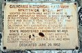
Historic landmark sign along SR58.
-
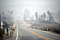
View of the community from the south.
-
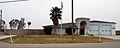
Kern County Fire Dept., Station 24.


See also
 In Spanish: McKittrick (California) para niños
