Medford (town), Wisconsin facts for kids
Quick facts for kids
Medford, Wisconsin
|
|
|---|---|

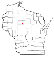
Location of Medford (town), Wisconsin
|
|
| Country | |
| State | |
| County | Taylor |
| Area | |
| • Total | 37.8 sq mi (97.8 km2) |
| • Land | 37.7 sq mi (97.6 km2) |
| • Water | 0.1 sq mi (0.2 km2) |
| Elevation | 1,470 ft (448 m) |
| Population
(2000)
|
|
| • Total | 2,216 |
| • Density | 58.8/sq mi (22.7/km2) |
| Time zone | UTC-6 (Central (CST)) |
| • Summer (DST) | UTC-5 (CDT) |
| Area code(s) | 715 & 534 |
| FIPS code | 55-50450 |
| GNIS feature ID | 1583684 |
| PLSS township | T31N R1E |
Medford is a town in Taylor County, Wisconsin, USA. A "town" here means a rural area, about seven miles by six miles. In 2000, about 2,216 people lived here. The City of Medford is actually mostly inside the town's borders!
Contents
Where is Medford Town?
Medford Town covers about 37.8 square miles (97.8 square kilometers). Most of this area, about 37.7 square miles (97.6 square kilometers), is land. Only a small part, 0.1 square miles (0.2 square kilometers), is water.
A Look at History
Early Surveys and Land
The western edge of what would become Medford Town was first measured in 1847. This was done by a team working for the U.S. government. This western edge is on the Fourth Principal Meridian, which is a main north-south line used to measure land in Wisconsin.
In late 1861, another team of surveyors marked all the section corners in the area. They walked through forests and swamps, using tools like a Gunter's chain and a Solar compass. After their work, the surveyor described the land. He said the land was "gently rolling or Level." The forests had trees like Hemlock, Birch, Sugar maple, fir, Spruce, and White Pine. The soil was good for farming, and many small streams flowed south through the area.
Railroads and Growth
The Medford area was mostly forest until 1873. That year, the Wisconsin Central Railroad built tracks north along the Black River. They were heading towards Ashland. The railroad set up a station on the river and named it Medford. This is how the City of Medford began.
To pay for the railroad, the company was given half of the land for eighteen miles on both sides of the tracks. This usually meant they owned the odd-numbered sections of land. The railroad planned the first part of the village of Medford in 1874. Around the same time, at least one sawmill was built in Medford. This led to more logging in the surrounding country.
How the Town Changed
When Taylor County was created in 1875, the town of Medford was six miles north to south, just like it is today. However, it used to cover the entire width of the county. This included all the areas that are now separate towns like Aurora and Goodrich.
By 1880, maps showed some roads leading out from Medford into the nearby countryside. One road followed what is now Highway 64 to the east and west. Other roads were early versions of streets like Perkins Street, Oriole Avenue, and Highway 13.
A map from 1900 shows the town becoming more settled. More roads were built, and families had homes along them. Most farms were 80 or 40 acres. There were rural schools at different locations, including near Perkinstown Avenue and Anderson Road. Some large areas north of Medford were still forests, with some odd sections still owned by the railroad.
The 1913 map shows even more roads and settlers. Another rural school was added two miles east of Medford on what would become Highway 64. A "Fair Ground" was marked on the east side of Medford. A new railroad, owned by Medford Lumber Co., angled northwest from Medford and then turned west towards Perkinstown.
People of Medford Town
In 2000, there were 2,216 people living in Medford Town. There were 821 households, and 637 of these were families. On average, about 58.8 people lived in each square mile.
Most people in the town were White (98.24%). A small number were Black, Native American, or Asian. Some people were from other races or had mixed backgrounds. About 0.23% of the population was Hispanic or Latino.
Households and Families
Out of all the households, 40.7% had children under 18 living there. Most households (67.5%) were married couples living together. About 6.6% were single mothers with no husband present. Around 18.0% of households were single individuals. About 5.6% of households had someone aged 65 or older living alone. The average household had 2.70 people, and the average family had 3.09 people.
Age and Income
The population was spread out by age. About 29.0% were under 18 years old. About 32.0% were between 25 and 44 years old. The median age in the town was 37 years. For every 100 females, there were about 105.6 males.
The median income for a household in the town was $46,912. For families, the median income was $51,188. Men generally earned more than women. The average income per person in the town was $20,261. A small number of families (3.4%) and people (4.3%) lived below the poverty line. This included 5.1% of those under 18 and 6.2% of those aged 65 or older.
See also
 In Spanish: Medford (condado de Taylor, Wisconsin) para niños

