Melia, Nebraska facts for kids
Quick facts for kids
Melia
|
|
|---|---|

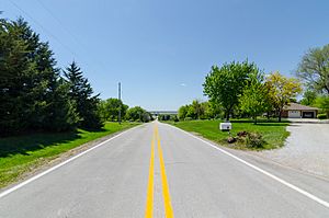
West on Melia Road overlooking the
Platte River, May 2017 |
|
| Country | United States |
| State | Nebraska |
| County | Sarpy |
| Area | |
| • Total | 1.44 sq mi (3.73 km2) |
| • Land | 1.44 sq mi (3.73 km2) |
| • Water | 0.00 sq mi (0.00 km2) |
| Elevation | 1,132 ft (345 m) |
| Population
(2020)
|
|
| • Total | 98 |
| • Density | 68.06/sq mi (26.27/km2) |
| Time zone | UTC-6 (Central (CST)) |
| • Summer (DST) | UTC-5 (CDT) |
| ZIP codes |
68028
|
| FIPS code | 31-31605 |
| GNIS feature ID | 835379 |
Melia is a small community located in Sarpy County, Nebraska, in the United States. It is known as a census-designated place (CDP). This means it's an area defined by the government for counting people, but it doesn't have its own local government like a city or town.
History of Melia
Melia was named after an early settler in the area. His name was John J. Melia. Long ago, this community was an important stop for trains. It was a station on the Chicago, Burlington, and Quincy Railroad. Railroads were very important for travel and moving goods across the country.
How Many People Live in Melia?
According to the 2020 census, about 98 people live in Melia. A census is like a big count of everyone living in a place. The government does this every ten years to learn about the population.
Black History Month on Kiddle
Distinguished African-American Artists:
 | Sharif Bey |
 | Hale Woodruff |
 | Richmond Barthé |
 | Purvis Young |

All content from Kiddle encyclopedia articles (including the article images and facts) can be freely used under Attribution-ShareAlike license, unless stated otherwise. Cite this article:
Melia, Nebraska Facts for Kids. Kiddle Encyclopedia.
