Menfro, Missouri facts for kids
Quick facts for kids
Menfro, Missouri
|
|
|---|---|

Location of Menfro, Missouri
|
|
| Country | United States |
| State | Missouri |
| County | Perry |
| Township | Bois Brule |
| Elevation | 358 ft (109 m) |
| Time zone | UTC-6 (Central (CST)) |
| • Summer (DST) | UTC-5 (CDT) |
| ZIP code |
63775
|
| Area code(s) | 573 |
| FIPS code | 29-47324 |
| GNIS feature ID | 722232 |
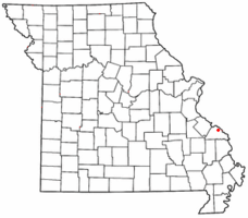
Menfro is a small, unincorporated community in Perry County, Missouri, United States. An unincorporated community is a town that doesn't have its own local government. Menfro is located in the northeastern part of Perry County. It is about 8 miles (13 km) northeast of Perryville.
Contents
How Menfro Got Its Name
People say that Menfro got its name in 1904. Officials from the St. Louis-San Francisco Railroad named it. They chose the name to honor three men. These men lost their lives on the river while bringing supplies for the railroad.
A Look Back at Menfro's History
Menfro started on a small piece of land. This land was part of a larger grant given to Levi Wiggin. In January 1877, this small area was divided up. It then became known as the Town of Menfro.
In September 1879, Valentine and Margaret Hoehn sold some land to Frederick Moldenhauer. This land is still owned by the Moldenhauer family today. It is home to the Moldenhauer Alfalfa Mill.
Menfro began as a stop for trains. It was on the St. Louis, Memphis & South Eastern Railroad line. Construction on this railroad started on September 22, 1902. The goal was to connect Perry County with St. Louis. This connection was planned to be ready for the 1904 World's Fair. A post office opened in Menfro in 1904. It stayed open until 1996.
Flooding in Menfro
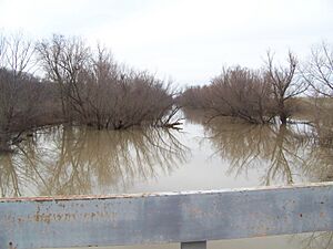
The town of Menfro is located near Cinque Hommes Creek. Local people often call this "Menfro Creek." This creek flows into the Mississippi River about a mile (1.6 km) downstream from Menfro.
When the Mississippi River's water level rises, Menfro Creek can flow backward. This means it takes in the rising water from the Mississippi. Because of this, Menfro often floods when the Mississippi River floods.
Menfro has been hit by three major floods. These happened in 1943, 1973, and 1993. Each time, the town was badly damaged. After the 1943 and 1973 floods, the town was rebuilt. However, after the 1993 flood, the town did not fully recover.
Menfro's Location and Landscape
Menfro is found in the Mississippi River Valley. It sits on a flat, low-lying area called the Bois Brule Bottom. The town is nestled between tall limestone cliffs on the west side of Bois Brule Bottom. Cinque Hommes Creek is directly to the east. Being in this location has made Menfro very likely to experience floods.
 | May Edward Chinn |
 | Rebecca Cole |
 | Alexa Canady |
 | Dorothy Lavinia Brown |


