Menstrie Glen facts for kids
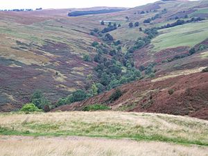
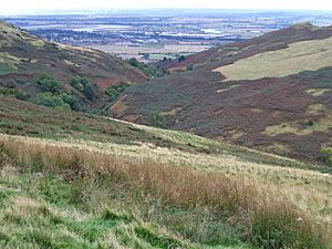
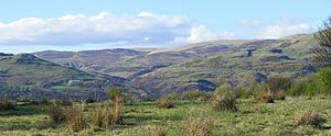
Menstrie Glen is a beautiful valley in Scotland. It sits between a hill called Dumyat and the main Ochil Hills. Long ago, people lived and farmed here, but now it's mostly used for sheep to graze. It also provides drinking water for people and is a great place for fishing and walking. There are even plans to plant more trees in parts of the glen.
Contents
What Menstrie Glen Looks Like
Most of Menstrie Glen is covered in rough grass where sheep eat. You'll also see a lot of Bracken plants. Along the edges of the streams and near old, empty settlements, there are broad-leaved trees.
The lowest part of the glen is about 20 meters above sea level, where it meets the flat land in Menstrie. The highest part, at the western end, is about 228 meters high.
Lossburn Reservoir
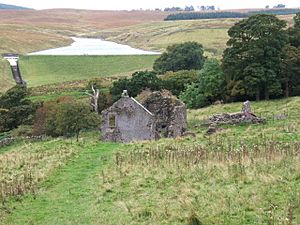
Near the top (western end) of the glen, you'll find the Lossburn Reservoir. This reservoir holds drinking water for local communities. It's also a popular spot for people who enjoy fishing. Water flows into the reservoir from the slopes of Dumyat and Loss Hill.
Below the reservoir, several streams join together. The Loss Burn and the Crunie Burn combine to form the Menstrie Burn. Other streams, like the Inchna Burns, also flow into the Menstrie Burn. Part of the Menstrie Burn forms the border between two areas: Stirlingshire and Clackmannanshire.
History of Menstrie Glen
For a very long time, Menstrie Glen has been used by people.
Early History
In the Middle Ages (around the 1400s), much of Menstrie Glen was owned by the King or Queen. It was mainly used for sheep to graze.
Later, by the early 1300s, the Clan Campbell family owned the land east of the Menstrie Burn. Some parts of the glen, like the lands of Jerah, were controlled by a group of monks called the Cistercians from Culross.
Farms and Settlements
In the 1700s, local landowners took over the glen. They rented out parts of the land to farmers. At one point, there were more than a dozen farms in the glen. One important landowner, James Wright, owned about half of the glen in the mid-1700s. He kept many notes about how he managed his land.
Even in the early 1800s, farming continued at places like Ashentrool, Loss, and Jerah. Today, you can still see the remains of these old farmsteads. Experts have even studied and photographed them from the air.
The farmstead of Jerah, located near the top of the glen, was used until the 1960s. After that, it was left empty and slowly fell into ruin. Now, no one lives in Menstrie Glen.
Visiting Menstrie Glen
Menstrie Glen is a great place for outdoor activities.
Walking and Hiking
You can reach the lower parts of the glen by following footpaths from the village of Menstrie. These paths also lead to routes that go up to the tops of Dumyat and Myreton Hill.
There are also farm tracks that you can use. One track starts from Menstrie and goes around the eastern and northern sides of the glen, leading to the ruins of Red Brae, near Jerah.
Another track starts from Sherrifmuir Road. It passes the Lossburn Reservoir and goes around the southern and western sides of the glen. This track eventually goes past Dumyat Farm and down to Cotkerse, which is west of Menstrie.
Future Plans
In 2008, the Menstrie Community Council suggested making it easier for people to visit the glen and adding things for visitors to enjoy.
More recently, in 2012, a forestry company announced plans to plant trees on the eastern and northern sides of the Menstrie Burn. They have been talking with the community council to make sure that people can still access the glen for walking and other fun activities.
The plan includes planting broadleaf trees on Myreton Hill, which will be visible from Menstrie and nearby villages. Other conifer trees will also be planted, which might be seen from further away. Tree planting started in the winter of 2014-2015, after the Forestry Commission approved the plans.
 | Lonnie Johnson |
 | Granville Woods |
 | Lewis Howard Latimer |
 | James West |


