Menterwolde facts for kids
Quick facts for kids
Menterwolde
|
|
|---|---|
|
Former municipality
|
|

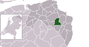
Location in Groningen
|
|
| Country | Netherlands |
| Province | Groningen |
| Municipality | Midden-Groningen |
| Established | 1 January 1990 |
| Ceased to exist | 1 January 2018 |
| Area | |
| • Total | 81.62 km2 (31.51 sq mi) |
| • Land | 80.33 km2 (31.02 sq mi) |
| • Water | 1.29 km2 (0.50 sq mi) |
| Elevation | 2 m (7 ft) |
| Population
(May 2014)
|
|
| • Total | 12,233 |
| • Density | 152/km2 (390/sq mi) |
| Time zone | UTC+1 (CET) |
| • Summer (DST) | UTC+2 (CEST) |
| Postcode |
9630–9639, 9649–9651
|
| Area code | 0598 |
Menterwolde was a municipality, which is like a local government area, in the Groningen province of the Netherlands. It was located in the northeastern part of the country.
On January 1, 2018, Menterwolde joined with two other municipalities. These were Hoogezand-Sappemeer and Slochteren. Together, they formed a new, bigger municipality called Midden-Groningen.
History of Menterwolde
Menterwolde itself was created on January 1, 1990. Before that, it was made up of three separate smaller areas. These areas were the municipalities of Meeden, Muntendam, and Oosterbroek. They all came together to form Menterwolde.
Geography and Location
Menterwolde was located in the Groningen province. This province is in the northeast of the Netherlands. It was specifically in the western part of a region called Oldambt.
The municipality of Menterwolde shared borders with several other areas. To its northwest and north was Slochteren. To the east was Oldambt. In the southeast, it bordered Pekela, and to the south was Veendam. Finally, to the southwest and west, it bordered Hoogezand-Sappemeer.
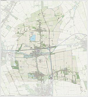
The main villages and population centers within Menterwolde were Borgercompagnie, Meeden, Muntendam, Noordbroek, Tripscompagnie, and Zuidbroek.
The total area of Menterwolde was about 81.62 km2 (31.51 sq mi). Most of this was land, about 80.33 km2 (31.02 sq mi). The rest, about 1.29 km2 (0.50 sq mi), was water.
Transportation Links
The Zuidbroek railway station is an important transport hub in the area. It is located on two different railway lines. These are the Harlingen–Nieuweschans railway and the Stadskanaal–Zuidbroek railway.
See also
 In Spanish: Menterwolde para niños
 | Lonnie Johnson |
 | Granville Woods |
 | Lewis Howard Latimer |
 | James West |


