Meriden, Kansas facts for kids
Quick facts for kids
Meriden, Kansas
|
|
|---|---|

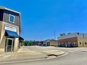
Downtown Meriden (2023)
|
|

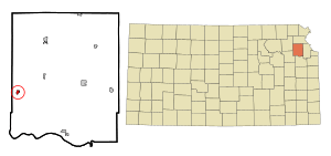
Location within Jefferson County and Kansas
|
|

|
|
| Country | United States |
| State | Kansas |
| County | Jefferson |
| Founded | 1872 |
| Incorporated | 1891 |
| Named for | Meriden, New Hampshire |
| Area | |
| • Total | 0.77 sq mi (1.98 km2) |
| • Land | 0.76 sq mi (1.96 km2) |
| • Water | 0.01 sq mi (0.02 km2) |
| Elevation | 974 ft (297 m) |
| Population
(2020)
|
|
| • Total | 744 |
| • Density | 966/sq mi (375.8/km2) |
| Time zone | UTC-6 (CST) |
| • Summer (DST) | UTC-5 (CDT) |
| ZIP code |
66512
|
| Area code | 785 |
| FIPS code | 20-45950 |
| GNIS ID | 478474 |
Meriden is a small city located in Jefferson County, Kansas, in the United States. It's a friendly place with a rich history. In 2020, about 744 people lived there. Meriden is part of the larger Topeka area.
Contents
History of Meriden
Meriden was started in 1872. A pioneer settler gave it its name. He named it after his old hometown, Meriden, New Hampshire.
Some of Meriden's streets are named after the first people who lived there. Owens Street is named after Albert Owens. He owned the land where Meriden was first planned out in 1872. Dawson Street is named after Dr. A. Dawson. He was the first person to build a house in Meriden.
A railroad once ran through the town. It was called the Atchison, Topeka and Santa Fe Railroad. A train station was built in Meriden in 1873. The railroad stopped running on December 31, 1996. Today, you can still see a few old train bridges nearby. They are on private property.
Meriden's Location and Size
Meriden is located at 39°11.4′N 95°34.1′W / 39.1900°N 95.5683°W. This means it's in the northeastern part of Kansas.
The city covers a total area of about 0.79 square miles (2.05 square kilometers). Most of this area is land. Only a very small part, about 0.01 square miles (0.02 square kilometers), is water.
People of Meriden
| Historical population | |||
|---|---|---|---|
| Census | Pop. | %± | |
| 1880 | 103 | — | |
| 1900 | 433 | — | |
| 1910 | 467 | 7.9% | |
| 1920 | 422 | −9.6% | |
| 1930 | 390 | −7.6% | |
| 1940 | 421 | 7.9% | |
| 1950 | 378 | −10.2% | |
| 1960 | 402 | 6.3% | |
| 1970 | 472 | 17.4% | |
| 1980 | 707 | 49.8% | |
| 1990 | 622 | −12.0% | |
| 2000 | 706 | 13.5% | |
| 2010 | 813 | 15.2% | |
| 2020 | 744 | −8.5% | |
| U.S. Decennial Census | |||
Meriden is part of the larger Topeka area. This area is known as the Topeka Metropolitan Statistical Area.
Meriden's Population in 2020
The 2020 United States census counted 744 people living in Meriden. There were 298 households and 190 families. The city had about 984 people per square mile.
About 26.1% of the people were under 18 years old. About 14.2% were 65 years or older. The average age in Meriden was 37.6 years. For every 100 females, there were about 97 males.
Meriden's Population in 2010
In 2010, the census showed 813 people lived in Meriden. There were 315 households and 215 families. The city had about 1042 people per square mile.
About 30.3% of the people were under 18 years old. About 8.2% were 65 years or older. The average age in the city was 33.5 years. There were slightly more males than females.
Education in Meriden
Students in Meriden go to schools in the Jefferson West USD 340 public school district. This district serves the community's educational needs.
See also
 In Spanish: Meriden (Kansas) para niños
 | Emma Amos |
 | Edward Mitchell Bannister |
 | Larry D. Alexander |
 | Ernie Barnes |

