Merrick Brook (Connecticut) facts for kids
Quick facts for kids Merrick Brook |
|
|---|---|

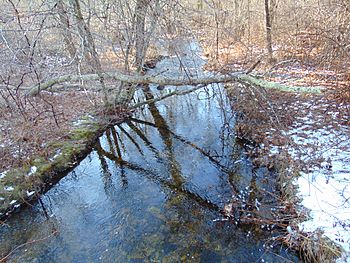
Merrick Brook in the winter
|
|
| County | United States |
| State | Connecticut |
| Towns | Chaplin, Hampton, Scotland |
| Physical characteristics | |
| Main source | Unnamed Pond, Chaplin, Connecticut 41°47′00″N 72°06′37″W / 41.7833°N 72.1104°W |
| River mouth | Shetucket River, Scotland, Connecticut 41°39′38″N 72°06′37″W / 41.6606°N 72.1104°W |
| Length | 12 miles (19 km) |
| Width |
|
| Basin features | |
| Population | 3,000 |
| Tributaries |
|
| Waterbodies | Large Unnamed Ponds |
Merrick Brook is a cool stream (a small river) that flows through three towns in Connecticut: Scotland, Hampton, and Chaplin. It starts its journey from a pond in eastern Chaplin. From there, it winds its way south until it joins the larger Shetucket River in the very southern part of Scotland. As it travels, it passes through places like Clark's Corner and the center of Scotland. This brook is also a great spot for fishing, especially for wild trout!
Contents
Exploring Merrick Brook
Where Does Merrick Brook Flow?
Merrick Brook begins its adventure in an unnamed pond located in Chaplin, Connecticut. It then travels south, making its way through the towns of Hampton and Scotland. The brook finally ends its journey when it flows into the Shetucket River. This river is an important part of the local water system.
How Big is Merrick Brook?
Merrick Brook is about 12 miles (or 19 kilometers) long. That's quite a distance for a stream! Its width can change a lot along its path. At its narrowest, it's about 5.6 feet (1.7 meters) wide. On average, it's around 39.1 feet (11.9 meters) wide. But in some places, it can spread out to be as wide as 117.8 feet (35.9 meters)!
What Lives in Merrick Brook?
Merrick Brook is known for its wild trout. These fish love the cool, clear water of the brook. Fishing for trout is a popular activity here. The brook also has smaller streams that flow into it, like Beaver Brook and Clover Brook. These smaller streams help keep Merrick Brook healthy and full of life.
Bridges and Paths Across the Brook
As Merrick Brook flows through the towns, many roads and paths cross over it. These crossings help people get around. For example, the brook goes under important roads like US Route 6 and Route 14. It also flows under the Air Line State Park Trail, which is a popular path for walking and biking. Even a railroad, the Providence and Worcester Railroad, crosses over the brook.

