Meservey, Iowa facts for kids
Quick facts for kids
Meservey, Iowa
|
|
|---|---|

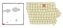
Location of Meservey, Iowa
|
|
| Country | |
| State | |
| County | Cerro Gordo |
| Area | |
| • Total | 1.50 sq mi (3.87 km2) |
| • Land | 1.50 sq mi (3.87 km2) |
| • Water | 0.00 sq mi (0.00 km2) |
| Elevation | 1,250 ft (381 m) |
| Population
(2020)
|
|
| • Total | 222 |
| • Density | 148.40/sq mi (57.30/km2) |
| Time zone | UTC-6 (Central (CST)) |
| • Summer (DST) | UTC-5 (CDT) |
| ZIP code |
50457
|
| Area code(s) | 641 |
| FIPS code | 19-51420 |
| GNIS feature ID | 0459009 |
Meservey is a small city in Cerro Gordo County, Iowa, United States. It is located in the state of Iowa. In 2020, about 222 people lived there. Meservey is part of the wider Mason City area.
Contents
History of Meservey
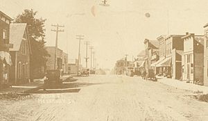
Meservey was founded in 1886. This happened soon after a railroad line was built. The railroad connected Mason City and Fort Dodge. The city was named after the Meservey brothers. They were railroad workers at that time.
A part of town to the west was first called Kausville. It later joined with Meservey. This area is still known as the "Kausville Addition" today.
Geography of Meservey
Meservey is located at coordinates 42°54′47″N 93°28′34″W / 42.91306°N 93.47611°W. This means it is in the northern part of the United States.
The city covers a total area of about 3.87 square kilometers (1.50 square miles). All of this area is land. There are no large bodies of water within the city limits.
Population and People
| Historical populations | ||
|---|---|---|
| Year | Pop. | ±% |
| 1900 | 193 | — |
| 1910 | 193 | +0.0% |
| 1920 | 282 | +46.1% |
| 1930 | 255 | −9.6% |
| 1940 | 282 | +10.6% |
| 1950 | 297 | +5.3% |
| 1960 | 331 | +11.4% |
| 1970 | 354 | +6.9% |
| 1980 | 324 | −8.5% |
| 1990 | 292 | −9.9% |
| 2000 | 252 | −13.7% |
| 2010 | 256 | +1.6% |
| 2020 | 222 | −13.3% |
| Source: and Iowa Data Center Source: |
||
Population in 2020
In 2020, the city of Meservey had 222 people living there. There were 105 households. The population density was about 148 people per square mile.
The median age in the city was 44.5 years. About 21.6% of the people were under 20 years old. About 26.6% were 65 years old or older. The population was almost evenly split between males and females.
Population in 2010
In 2010, Meservey had 256 people. There were 122 households. The population density was about 169 people per square mile.
The median age was 46.3 years. About 17.2% of residents were under 18. About 25.8% were 65 or older.
Schools in Meservey
Meservey is part of the West Fork Community School District. This district was formed in 2011. It was created when several smaller school districts joined together.
Before 2011, Meservey was part of the Sheffield–Chapin–Meservey–Thornton (SCMT) district. That district was formed in 2007.
Meservey School Building
The original Meservey school building was built in the 1940s. It was a K–12 school, meaning it taught all grades from kindergarten to high school. In 1963, it became an elementary and junior high school. Later, it only served elementary students.
Due to fewer students, the building closed in 1983. All classes moved to the Thornton facility. The Meservey school building was torn down around 1993. The land where it stood is now a park called Schoolhouse Park.
The high school sports teams in Meservey were called the "Rockets." When Meservey and Thornton schools combined, their mascot became the "Lancers." Later, when more schools joined, the new mascot became the "Warhawks." All students now attend schools in Sheffield and Rockwell.
See also
 In Spanish: Meservey (Iowa) para niños
 | William M. Jackson |
 | Juan E. Gilbert |
 | Neil deGrasse Tyson |


