Metepenagiag Mi'kmaq Nation facts for kids
Quick facts for kids
Metepenagiag Mi'kmaq Nation
|
|
|---|---|
| Country | Canada |
| Province | New Brunswick |
| County | Northumberland County |
| Established | 1783 |
| Area | |
| • Total | 39.07 km2 (15.09 sq mi) |
| Lowest elevation | 0 m (0 ft) |
| Population
(2006)
|
|
| • Total | 551 |
| Time zone | UTC-4 (Atlantic (AST)) |
| • Summer (DST) | UTC-3 (ADT) |
| Area code(s) | 506 / 428 |
| NTS Map | 021I13 |
| Website | http://www.metepenagiag.ca/ |
| Postal code span: | |
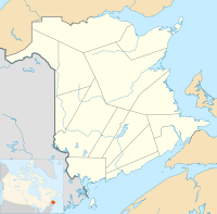
Metepenagiag (pronounced MET-EHH-PE-NAH-GHEE-AH), also known as Red Bank, is a Mi'kmaq First Nation community in New Brunswick, Canada. It is located across the Miramichi River from Sunny Corner. This community is very special because it has been home to the Mi'kmaq people for over 3,000 years. This makes it the oldest community in New Brunswick where people have lived continuously.
Contents
Ancient Roots of Metepenagiag
The Metepenagiag Mi'kmaq Nation is found where the Miramichi River meets the tide. For thousands of years, Mi’kmaq communities lived along New Brunswick’s northeastern coast. They settled near tidal estuaries, which are places where saltwater from the ocean flows inland.
These estuaries create a special environment for certain fish. These fish, like salmon, sturgeon, and eels, are called "anadromous." This means they live in saltwater but swim up freshwater rivers to lay their eggs. Many of these fish would swim past the 'head of tide' and into smaller freshwater streams.
Even though Metepenagiag was officially recognized in 1783, people have lived there for over 3,000 years. This makes it the oldest place in New Brunswick where people have continuously lived.
The Augustine Mound Discovery
In 1972, an important discovery showed just how old the community was. A man named Joseph Mike Augustine read an article about an ancient burial mound in Arizona. This reminded him of a mound near his home. His father had often taken him there when they were hunting caribou. They would stop to rest at the mound.
Joseph's father told him stories about the mound. He said that in the past, Indigenous people would celebrate there. They would build a fire in the middle of the mound and dance around it. His father explained that these people were the ones who built the mound.
The items found at this site, called the Augustine Mound, and another nearby site, the Oxbow site, proved that Metepenagiag had been lived in for over 3,000 years without interruption. These findings also showed that the community traded with other First Nations. Their trade routes reached as far west as the Ohio River Valley.
There has been some discussion among residents about the name "The Augustine Mound." While Joe Mike Augustine first brought attention to the site, many residents already knew it existed. Also, the name might suggest it's only a burial place for the Augustine family. While some Augustine family members are likely buried there, it was probably a community burial site. This means many ancestors from the oldest families in Metepenagiag are buried there. Some people feel that "Metepenagiag Mound" would be a better name. It would be more inclusive and honor all those buried beneath it.
In 1975, the Augustine Mound was named a National Historic Site of Canada. The mound is similar to the detailed burial practices of the Adena culture from the Ohio Valley. It contained materials not found locally, like copper from the Lake Superior area. This suggests that the people of Red Bank were part of a large trade network in northeastern North America before European contact. Some experts also believe that people from the Maritimes adopted parts of the Adena culture and beliefs. Old pottery pieces found at Red Bank also show the type of ceramic technology used by Maritime First Nations 2,500 to 3,000 years ago.
The Oxbow Archaeological Site
In 1982, another important place, the Oxbow archaeological site, was also named a National Historic Site of Canada. This site is located on the Metepenagiag Mi’kmaq Nation's land, on a bend of the Southwest Miramichi River. It is important because it shows "3,000 years of continuous Mi’kmaq use of the site."
The Oxbow site has evidence of 3,000 years of Mi’kmaq history, from 1,000 BC to today. The river's yearly floods have created many layers of soil. Each layer preserves the cultural development of the people over time. This deep layering is very rare in Atlantic Canada. Since 1975, over 100 more archaeological sites have been found in the area. Today, the Metepenagiag First Nation has its own Metepenagiag Heritage Park, which helps share this rich history.
History of Metepenagiag Lands
In 1808, the Red Bank Band was given about 10,000 acres of land by the New Brunswick government. However, by the late 1830s, many settlers and people without permission had taken over almost all of this land. Only the village at Red Bank and some back wood lots were left for the Band.
Later, under a policy called the Specific Claims Policy (from 2005), it was found that a land surrender from 1895 was not valid. This meant the Metepenagiag Mi'kmaq Nation was able to negotiate for more land.
Notable People from Metepenagiag
- Joe Mike Augustine - He discovered the Augustine Mound.
- Noah Augustine - He was an Indigenous rights activist and a former chief of the community.
 | Dorothy Vaughan |
 | Charles Henry Turner |
 | Hildrus Poindexter |
 | Henry Cecil McBay |


