
Midtown, Wichita, Kansas facts for kids
Quick facts for kids
Midtown
|
|
|---|---|
| Country | United States |
| State | Kansas |
| County | Sedgwick |
| City | Wichita |
| Population
(2016)
|
|
| • Total | 11,147 |
| ZIP code |
67202, 67203, 67214
|
| Area code | 316 |
Midtown is a lively neighborhood in Wichita, Kansas, in the United States. It's a mix of shops, businesses, and homes located on the east side of the Little Arkansas River. Midtown is special because it's the oldest neighborhood in the entire city of Wichita.
Contents
History of Midtown

Midtown is where the city of Wichita first began. It was planned out in 1865, and people started settling there in the late 1860s and 1870s.
In 1868, Darius Munger built the very first house in Wichita. It was made from cottonwood logs and stood where Waco and 9th Streets are today. This house was super important! It served as a hotel, a place for justice, a community center, and even the post office.
By 1869, Darius Munger owned several buildings. In 1870, he and Bill “Dutch Bill” Griffenstein created the first street maps for the city. This included important streets like Main Street and Broadway. Griffenstein even offered free land on Main Street to attract new businesses. During this time, Wichita's first jail and first school also opened in what is now Midtown.
The city kept growing north. People first built large, fancy Victorian homes. But as the city needed more services, property taxes went up. So, residents started dividing their big lots into smaller ones and selling them. This made the neighborhood more crowded with more buildings.
Midtown continued to grow until the 1940s. Many workers from Wichita's growing aviation (airplane-making) industry moved into the area. However, by the 1960s, Midtown started to face some challenges.
In 1972, local residents decided to take action. They worked together to save their neighborhood. They partnered with the city government to have many parts of Midtown officially recognized as historic districts. This helps protect the old buildings and the area's unique history.
Midtown's Location
Midtown is located between 21st Street to the north and Central Avenue to the south. To the west is the Little Arkansas River, and to the east are the BNSF and Union Pacific train tracks.
It's right next to Downtown Wichita to the north. Midtown also borders El Pueblo to the north, McAdams to the east, and North Riverside to the west. A small part of Midtown even overlaps with the Riverside neighborhood.
Schools in Midtown
Learning and Education
Wichita Public Schools runs five different schools and programs in the Midtown area:
- Gateway Alternate Program Center
- Horace Mann Dual Language Magnet
- Irving Elementary School
- Park Elementary School
- Wichita North High School
The Roman Catholic Diocese of Wichita also manages one Catholic elementary school in the neighborhood, called St. Patrick School.
Media and TV Stations
Midtown is home to some important TV stations. KSNW, which is the NBC television station for Wichita, broadcasts from its studios on North Main Street in Midtown. Another television station, KCTU, also has its studios located in this neighborhood, at 9th and Water Streets.
Parks and Fun Places
The city's Park and Recreation Department takes care of six parks in Midtown. These parks offer great places for outdoor activities and relaxation:
- Emporia Park: This park is about 1 acre and has a playground. You can find it on North Emporia Avenue.
- Hope Park: This small park is about 0.1 acres. It's at the corner of North Emporia Avenue and East 14th Street and also has a playground. It used to be called the Midtown Mini-Park.
- North Woodland Park: This is a larger park, about 20 acres, located on West 21st Street along the Little Arkansas River. It has a playground, a softball field, a basketball court, and the Hispanic Senior Center.
- Otis Park: A small park, about 0.54 acres, located at North Market Street and 13th Street.
- Prospect Park: This park is similar in size to Otis Park, also 0.54 acres, and has a playground. It's right across 13th Street from Otis Park.
- Victoria Park: This is a 0.37-acre park on a traffic island at 17th Street and Park Place. It features a special fountain called a National Humane Alliance fountain.
Culture and Interesting Spots

Places to Visit
- Kansas African American Museum: This museum is a key point of interest in Midtown. It celebrates the history and culture of African Americans in Kansas.
Getting Around Midtown
Broadway is the main street that runs north-south through Midtown. 13th Street and Murdock Street are the main streets that run east-west.
Other important roads include:
- Waco Avenue: Runs north-south, a few blocks west of Broadway.
- 21st Street: Runs east-west along the northern edge of the neighborhood.
- Central Avenue: Runs east-west along the southern edge of the neighborhood.
Wichita Transit provides bus service in Midtown. You can catch buses on routes 13, 17, 25, and 27 to travel around the area.
The BNSF Railway and Union Pacific Railroad also have freight train lines that run north-south just east of Midtown, next to Santa Fe Avenue.
Gallery
-
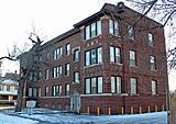
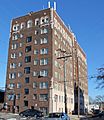
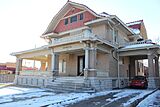
Adeline Apartments (2013)
-
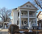
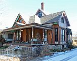
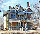
Bond-Sullivan House (2013)
-
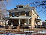
Bowers House (2013)
-

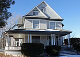
Chapman-Noble House (2013)
-
Comley House (2013)
-
Commodore Apartments (2013)
-
Edward M. Kelly House (2013)
-
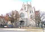
First Presbyterian Church (2018)
-
Gelbach House (2013)
-
Hypatia House (2013)
-
Market Street Cottage (2013)
-
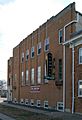
Murdock Theatre (2018)
-
Riverview Apartments (2013)
-
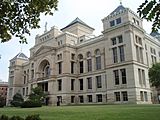
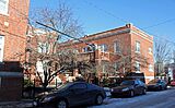
Old Sedgwick County Courthouse (2009)
-
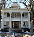
William Sternberg House (2013)


