Milliken, Colorado facts for kids
Quick facts for kids
Town of Milliken, Colorado
|
|
|---|---|

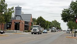
Broad Street in Milliken.
|
|
| Nickname(s):
The hub of northern Colorado
|
|

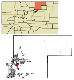
Location of Milliken in Weld County, Colorado.
|
|
| Country | |
| State | |
| County | Weld |
| Incorporated (town) | October 1, 1910 |
| Government | |
| • Type | Statutory Town |
| Area | |
| • Total | 12.90 sq mi (33.41 km2) |
| • Land | 12.81 sq mi (33.19 km2) |
| • Water | 0.09 sq mi (0.22 km2) |
| Elevation | 4,751 ft (1,448 m) |
| Population
(2020)
|
|
| • Total | 8,386 |
| • Density | 650.08/sq mi (251.00/km2) |
| Time zone | UTC-7 (Mountain (MST)) |
| • Summer (DST) | UTC-6 (MDT) |
| ZIP code |
80543
|
| Area code(s) | 970 |
| FIPS code | 08-50480 |
| GNIS feature ID | 0180708 |
| Website | Town of Milliken |
Milliken is a small town in Weld County, Colorado, United States. It is a "statutory town," which means it follows certain state laws for how it is run. In 2020, about 8,386 people lived in Milliken.
Contents
History of Milliken
The town of Milliken is named after a judge named John D. Milliken.
Early Days and Growth
The first community in this area was called Hillsboro. It started in the 1860s as a place where farmers could trade their goods. This trading post was located along the Denver, Laramie, and Northwestern Railroad.
By 1908, the town of Milliken had grown up close to Hillsboro. In 1910, Hillsboro officially became part of Milliken.
Challenges and Changes
In the 1910s, several fires caused a lot of damage to the town. Also, the Denver, Laramie, and Northwestern Railroad stopped running in 1917.
Milliken remained mostly a farming community for many years. This was true even during the Great Depression and the World Wars. In the 1950s, two large buildings were built to store potatoes.
Modern Development
The late 1960s and early 1970s saw a big increase in new homes being built. This was a time of growth for the town.
In 1985 and 1986, the roads in Milliken were paved. As the town continued to grow, the local government needed more space. In 1996, they moved into the Milliken Community Complex. New buildings were added later, including the Public Work Facility in 2004 and a new police station in 2009.
Geography
Milliken is located at coordinates 40°19′52″N 104°51′36″W / 40.33111°N 104.86000°W. This helps us find its exact spot on a map.
The town covers a total area of about 5.7 square miles (14.7 square kilometers). All of this area is land.
Population
The population of Milliken has grown quite a bit over the years. Here's how many people lived there during different census years:
| Historical population | |||
|---|---|---|---|
| Census | Pop. | %± | |
| 1920 | 372 | — | |
| 1930 | 483 | 29.8% | |
| 1940 | 531 | 9.9% | |
| 1950 | 510 | −4.0% | |
| 1960 | 630 | 23.5% | |
| 1970 | 702 | 11.4% | |
| 1980 | 1,506 | 114.5% | |
| 1990 | 1,605 | 6.6% | |
| 2000 | 2,888 | 79.9% | |
| 2010 | 5,610 | 94.3% | |
| 2020 | 8,386 | 49.5% | |
Schools
Milliken is part of the Weld Re-5J School District. Students in Milliken attend several schools:
- Milliken Elementary School
- Milliken Middle School
- Knowledge Quest Academy (KQA)
For high school, students from Milliken go to Roosevelt High School. This high school is located in the nearby town of Johnstown.
See also
 In Spanish: Milliken (Colorado) para niños

