Mina, Nevada facts for kids
Quick facts for kids
Mina, Nevada
|
|
|---|---|
 |
|
| Country | United States |
| State | Nevada |
| County | Mineral |
| Founded | 1905 |
| Named for | Ferminia Sarras |
| Area | |
| • Total | 2.41 sq mi (6.24 km2) |
| • Land | 2.41 sq mi (6.23 km2) |
| • Water | 0.00 sq mi (0.00 km2) |
| Elevation | 4,546 ft (1,386 m) |
| Population
(2020)
|
|
| • Total | 127 |
| • Density | 52.76/sq mi (20.37/km2) |
| Time zone | UTC-8 (PST) |
| • Summer (DST) | UTC-7 (PDT) |
| ZIP code |
89422
|
| Area code(s) | 775 |
| FIPS code | 32-46800 |
| GNIS feature ID | 0842148 |
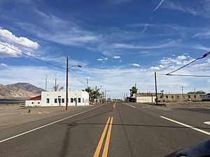
Mina is a small town in Mineral County, located in west-central Nevada, United States. It's a place where people live, but it's not officially a city or town with its own government. You can find Mina along U.S. Route 95. The town sits high up, about 4,560 feet (1,390 meters) above sea level. In 2020, about 127 people lived there.
Contents
A Look Back at Mina's History
Mina started as a railroad town in 1905. It was named after a famous prospector and large landowner named Ferminia Sarras. People called her the "Copper Queen."
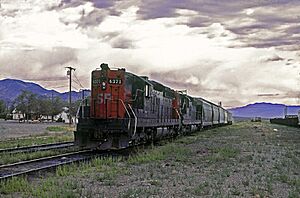
The Carson and Colorado Railway, which was part of the Southern Pacific Railroad, had a station in Mina. This railroad is no longer there; the last part of it closed in 1985. But long ago, there was a special local train called the "Slim Princess." Native Americans could ride on top of the railcars for free! Passengers and crew would even shoot wild game from the open windows. The train moved so slowly that hunters could get off, pick up their game, and get back on board.
How Mina Got Its Name
There are a couple of ideas about how Mina got its name. Some people think the name comes from a Spanish word that means "mine." This makes sense because there were mines nearby.
Other people say that John C. Fulton, a manager for the Southern Pacific Railroad, named the town after Fermina Sarras. She was a woman from Nicaragua who was working on copper mines in the area.
Originally, the railroad planned to put a station in a place called Sodaville. But the railroad and the people selling land couldn't agree. So, Mina was built two miles north of Sodaville instead.
Mina's Location and Surroundings
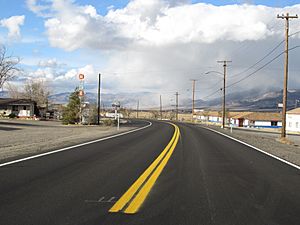
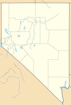
Mina is located in the Soda Spring Valley, which is in the eastern part of Mineral County. It's right along U.S. Route 95. Mina is about 32 miles (51 km) southeast of Hawthorne and 70 miles (110 km) northwest of Tonopah.
The U.S. Census Bureau says that the area of Mina is about 2.41 square miles (6.24 square kilometers). Almost all of this area is land, with only a tiny bit of water.
Mina's Climate
Mina has a semi-arid climate. This means it's usually dry, but not as dry as a true desert. You'll find this type of climate in areas around deserts, often called steppe regions.
| Climate data for Mina, Nevada, 1991–2020 normals, extremes 1896–present | |||||||||||||
|---|---|---|---|---|---|---|---|---|---|---|---|---|---|
| Month | Jan | Feb | Mar | Apr | May | Jun | Jul | Aug | Sep | Oct | Nov | Dec | Year |
| Record high °F (°C) | 71 (22) |
78 (26) |
89 (32) |
96 (36) |
102 (39) |
106 (41) |
111 (44) |
108 (42) |
105 (41) |
94 (34) |
81 (27) |
70 (21) |
111 (44) |
| Mean maximum °F (°C) | 60.9 (16.1) |
65.9 (18.8) |
75.0 (23.9) |
83.8 (28.8) |
91.0 (32.8) |
100.1 (37.8) |
104.0 (40.0) |
101.8 (38.8) |
96.3 (35.7) |
86.6 (30.3) |
72.0 (22.2) |
60.3 (15.7) |
104.5 (40.3) |
| Mean daily maximum °F (°C) | 49.0 (9.4) |
54.0 (12.2) |
62.2 (16.8) |
68.3 (20.2) |
77.7 (25.4) |
88.9 (31.6) |
97.4 (36.3) |
95.6 (35.3) |
86.4 (30.2) |
72.4 (22.4) |
58.3 (14.6) |
47.6 (8.7) |
71.5 (21.9) |
| Daily mean °F (°C) | 38.2 (3.4) |
42.4 (5.8) |
49.0 (9.4) |
54.7 (12.6) |
64.1 (17.8) |
74.4 (23.6) |
82.2 (27.9) |
79.8 (26.6) |
70.5 (21.4) |
57.5 (14.2) |
45.8 (7.7) |
36.9 (2.7) |
58.0 (14.4) |
| Mean daily minimum °F (°C) | 27.3 (−2.6) |
30.8 (−0.7) |
35.7 (2.1) |
41.0 (5.0) |
50.5 (10.3) |
59.8 (15.4) |
67.0 (19.4) |
64.0 (17.8) |
54.5 (12.5) |
42.6 (5.9) |
33.2 (0.7) |
26.2 (−3.2) |
44.4 (6.9) |
| Mean minimum °F (°C) | 10.4 (−12.0) |
15.4 (−9.2) |
19.6 (−6.9) |
25.4 (−3.7) |
35.4 (1.9) |
42.3 (5.7) |
55.8 (13.2) |
52.3 (11.3) |
39.1 (3.9) |
26.4 (−3.1) |
16.9 (−8.4) |
8.9 (−12.8) |
6.3 (−14.3) |
| Record low °F (°C) | −23 (−31) |
−20 (−29) |
0 (−18) |
7 (−14) |
20 (−7) |
21 (−6) |
32 (0) |
34 (1) |
18 (−8) |
10 (−12) |
0 (−18) |
−23 (−31) |
−23 (−31) |
| Average precipitation inches (mm) | 0.48 (12) |
0.54 (14) |
0.46 (12) |
0.57 (14) |
0.83 (21) |
0.33 (8.4) |
0.53 (13) |
0.24 (6.1) |
0.23 (5.8) |
0.57 (14) |
0.29 (7.4) |
0.50 (13) |
5.57 (140.7) |
| Average snowfall inches (cm) | 2.0 (5.1) |
1.7 (4.3) |
1.0 (2.5) |
0.7 (1.8) |
0.2 (0.51) |
0.0 (0.0) |
0.0 (0.0) |
0.0 (0.0) |
0.0 (0.0) |
0.0 (0.0) |
0.8 (2.0) |
1.4 (3.6) |
7.8 (19.81) |
| Average precipitation days (≥ 0.01 in) | 3.4 | 4.4 | 4.1 | 3.6 | 4.4 | 2.4 | 2.6 | 1.8 | 2.0 | 2.2 | 2.2 | 3.3 | 36.4 |
| Average snowy days (≥ 0.1 in) | 1.4 | 1.3 | 0.7 | 0.4 | 0.0 | 0.0 | 0.0 | 0.0 | 0.0 | 0.0 | 0.5 | 1.2 | 5.5 |
| Source 1: NOAA | |||||||||||||
| Source 2: National Weather Service | |||||||||||||
Population Changes in Mina
| Historical population | |||
|---|---|---|---|
| Census | Pop. | %± | |
| 2010 | 155 | — | |
| 2020 | 127 | −18.1% | |
| U.S. Decennial Census | |||
The number of people living in Mina has changed over the years. In 2010, there were 155 residents. By 2020, the population had decreased slightly to 127 people.
See also
 In Spanish: Mina (Nevada) para niños
 | Delilah Pierce |
 | Gordon Parks |
 | Augusta Savage |
 | Charles Ethan Porter |


