Mineral County, Nevada facts for kids
Quick facts for kids
Mineral County
|
||
|---|---|---|
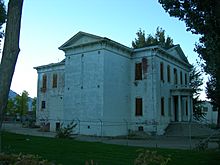
Historic 1883 Esmeralda County and Mineral County Courthouse.
|
||
|
||
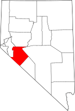
Location within the U.S. state of Nevada
|
||
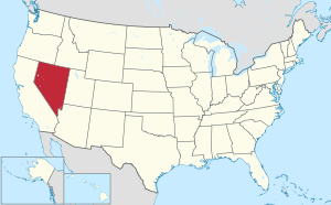 Nevada's location within the U.S. |
||
| Country | ||
| State | ||
| Founded | 1911 | |
| Named for | Mineral | |
| Seat | Hawthorne | |
| Largest community | Hawthorne | |
| Area | ||
| • Total | 3,813 sq mi (9,880 km2) | |
| • Land | 3,753 sq mi (9,720 km2) | |
| • Water | 60 sq mi (200 km2) 1.6% | |
| Population
(2020)
|
||
| • Total | 4,554 | |
| • Density | 1.19434/sq mi (0.46114/km2) | |
| Time zone | UTC−8 (Pacific) | |
| • Summer (DST) | UTC−7 (PDT) | |
| Congressional district | 4th | |
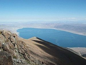
Mineral County is a county located in the U.S. state of Nevada. It is known for its beautiful natural areas like Walker Lake. As of the 2020 census, about 4,554 people lived here. This makes it one of the least populated counties in Nevada. Its main town and county seat is Hawthorne.
Contents
History of Mineral County
Mineral County was created in 1911. It was formed from a part of Esmeralda County. The county got its name because there are many valuable minerals in the area. The town of Hawthorne has always been its county seat. A special sign, called Nevada Historical Marker 16, marks the county's history. You can find this marker on U.S. Highway 95 near Walker Lake.
Geography of Mineral County
Mineral County covers a total area of about 3,813 square miles (9,876 square kilometers). Most of this area, 3,753 square miles (9,720 square kilometers), is land. The remaining 60 square miles (155 square kilometers) is water. The highest point in Mineral County is Mount Grant. It stands tall at 11,285 feet (3,440 meters).
Major Roads in Mineral County
Several important roads pass through Mineral County. These highways help people travel across the region.
 Interstate 11 (Future)
 U.S. Route 6
 U.S. Route 95
 U.S. Route 95 Alternate
 U.S. Route 95 Truck (Hawthorne)
 State Route 359
 State Route 360
 State Route 361
Neighboring Counties
Mineral County shares borders with several other counties:
- Lyon County - to the northwest
- Churchill County - to the north
- Nye County - to the northeast
- Esmeralda County - to the southeast
- Mono County, California - to the southwest
Protected Natural Areas
Parts of two national forests are located within Mineral County. These areas help protect nature and offer places for outdoor activities.
- Inyo National Forest (part)
- Toiyabe National Forest (part)
Population Trends in Mineral County
The population of Mineral County has changed over the years. Here's a look at how many people have lived there during different census years.
| Historical population | |||
|---|---|---|---|
| Census | Pop. | %± | |
| 1920 | 1,848 | — | |
| 1930 | 1,863 | 0.8% | |
| 1940 | 2,342 | 25.7% | |
| 1950 | 5,560 | 137.4% | |
| 1960 | 6,329 | 13.8% | |
| 1970 | 7,051 | 11.4% | |
| 1980 | 6,217 | −11.8% | |
| 1990 | 6,475 | 4.1% | |
| 2000 | 5,071 | −21.7% | |
| 2010 | 4,772 | −5.9% | |
| 2020 | 4,554 | −4.6% | |
| 2023 (est.) | 4,528 | −5.1% | |
| U.S. Decennial Census 1790-1960 1900-1990 1990-2000 2010-2018 |
|||
Understanding the 2010 Census
In 2010, there were 4,772 people living in Mineral County. These people lived in 2,240 households. The average number of people in each household was about 2.11. The average age of people in the county was 49.2 years old.
Communities in Mineral County
Mineral County does not have any officially incorporated cities or towns. However, it has several communities where people live.
Census-Designated Places
These are areas that the U.S. Census Bureau defines for statistical purposes. They are like towns but do not have their own local government.
Unincorporated Communities
These are smaller communities that are not officially part of any city or town.
Other Places to Know
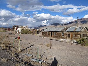
Mineral County also has several other interesting places, including some historic sites and former mining towns.
See also
 In Spanish: Condado de Mineral (Nevada) para niños
 | Kyle Baker |
 | Joseph Yoakum |
 | Laura Wheeler Waring |
 | Henry Ossawa Tanner |


