Minburn, Alberta facts for kids
Quick facts for kids
Minburn
|
|
|---|---|
|
Hamlet
|
|
| Hamlet of Minburn | |
| Country | Canada |
| Province | Alberta |
| Region | Central Alberta |
| Census Division | No. 10 |
| Municipal district | County of Minburn No. 27 |
| Village | June 24, 1919 |
| Dissolution (hamlet) | July 1, 2015 |
| Area
(2021)
|
|
| • Land | 0.57 km2 (0.22 sq mi) |
| Elevation | 635 m (2,083 ft) |
| Population
(2021)
|
|
| • Total | 78 |
| • Density | 136.1/km2 (352/sq mi) |
| Time zone | UTC−7 (MST) |
| • Summer (DST) | UTC−6 (MDT) |
| Highways | 16 |
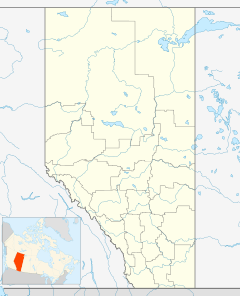
Minburn is a small community called a hamlet in central, Alberta, Canada. It is part of the County of Minburn No. 27. You can find it along the Yellowhead Highway and the Canadian National Railway. It's about 37 kilometers (23 miles) west of the town of Vermilion and 143 kilometers (89 miles) east of the city of Edmonton.
History of Minburn
Minburn officially became a village on June 24, 1919. Many years later, on July 1, 2015, it changed from being a village back to a hamlet. Now, it is managed by the County of Minburn No. 27.
Minburn's Population
Every few years, Canada counts its population. This is called a census.
Population in 2021
In the 2021 Census, Statistics Canada counted 78 people living in Minburn. These people lived in 37 homes. This was a decrease from its population in 2016. Minburn covers an area of 0.57 square kilometers (0.22 square miles).
Population in 2016
In the 2016 Census, Minburn had 115 people. They lived in 49 homes. This was a small increase from its population in 2011. At that time, Minburn covered an area of 0.73 square kilometers (0.28 square miles).


