County of Minburn No. 27 facts for kids
Quick facts for kids
County of Minburn No. 27
|
|
|---|---|

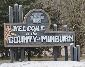
Welcome sign
|
|

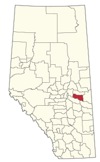
Location within Alberta
|
|
| Country | Canada |
| Province | Alberta |
| Region | Central Alberta |
| Census division | 10 |
| Established | 1942 |
| Incorporated | 1965 (County) |
| Area
(2021)
|
|
| • Land | 2,850.37 km2 (1,100.53 sq mi) |
| Population
(2021)
|
|
| • Total | 3,014 |
| • Density | 1.1/km2 (3/sq mi) |
| Time zone | UTC−7 (MST) |
| • Summer (DST) | UTC−6 (MDT) |
The County of Minburn No. 27 is a municipal district in east central Alberta, Canada. Its municipal office is located in the Town of Vegreville. Located in Census Division No. 10, the County of Minburn No. 27 was formed as a county on January 1, 1965, from the former Municipal District of Minburn No. 72.
Geography
Communities and localities
|
The following urban municipalities are surrounded by the County of Minburn No. 27.
The following hamlets are located within the County of Minburn No. 27.
|
The following localities are located within the County of Minburn No. 27.
|
Demographics
In the 2021 Census of Population conducted by Statistics Canada, the County of Minburn No. 27 had a population of 3,014 living in 1,138 of its 1,337 total private dwellings, a change of -5.5% from its 2016 population of 3,188. With a land area of 2,850.37 km2 (1,100.53 sq mi), it had a population density of 1.1/km2 (2.8/sq mi) in 2021.
In the 2016 Census of Population conducted by Statistics Canada, the County of Minburn No. 27 had a population of 3,188 living in 1,184 of its 1,380 total private dwellings, a -5.8% change from its 2011 population of 3,383. With a land area of 2,913.02 km2 (1,124.72 sq mi), it had a population density of 1.1/km2 (2.8/sq mi) in 2016.


